You are here: Home > Network List > TA - USArray Transportable Network (new EarthScope stations) Stations List
> Station G04A Mulino, OR, USA > Earthquake Result Viewer
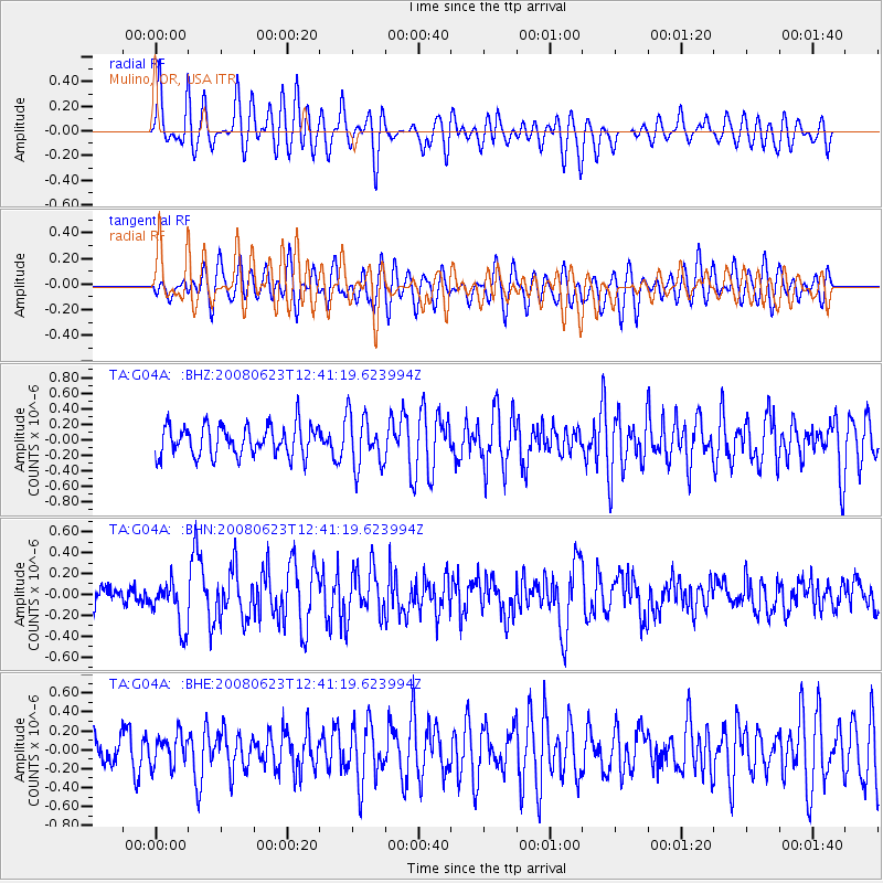
G04A Mulino, OR, USA - Earthquake Result Viewer
*The percent match for this event was below the threshold and hence no stack was calculated.
| Earthquake location: |
Kuril Islands |
| Earthquake latitude/longitude: |
46.5/153.3 |
| Earthquake time(UTC): |
2008/06/23 (175) 12:32:12 GMT |
| Earthquake Depth: |
10 km |
| Earthquake Magnitude: |
5.6 MB, 5.2 MS, 5.6 MW, 5.6 MW |
| Earthquake Catalog/Contributor: |
WHDF/NEIC |
|
| Network: |
TA USArray Transportable Network (new EarthScope stations) |
| Station: |
G04A Mulino, OR, USA |
| Lat/Lon: |
45.21 N/122.48 W |
| Elevation: |
273 m |
|
| Distance: |
55.9 deg |
| Az: |
58.114 deg |
| Baz: |
303.904 deg |
| Ray Param: |
$rayparam |
*The percent match for this event was below the threshold and hence was not used in the summary stack. |
|
| Radial Match: |
63.645363 % |
| Radial Bump: |
400 |
| Transverse Match: |
50.813423 % |
| Transverse Bump: |
400 |
| SOD ConfigId: |
2504 |
| Insert Time: |
2010-03-06 17:42:06.202 +0000 |
| GWidth: |
2.5 |
| Max Bumps: |
400 |
| Tol: |
0.001 |
|
Signal To Noise
| Channel | StoN | STA | LTA |
| TA:G04A: :BHN:20080623T12:41:19.623994Z | 2.7230723 | 2.2054353E-7 | 8.0990695E-8 |
| TA:G04A: :BHE:20080623T12:41:19.623994Z | 0.86755925 | 1.658446E-7 | 1.9116227E-7 |
| TA:G04A: :BHZ:20080623T12:41:19.623994Z | 1.7120415 | 3.326345E-7 | 1.9429113E-7 |
| Arrivals |
| Ps | |
| PpPs | |
| PsPs/PpSs | |


