You are here: Home > Network List > TA - USArray Transportable Network (new EarthScope stations) Stations List
> Station G04A Mulino, OR, USA > Earthquake Result Viewer
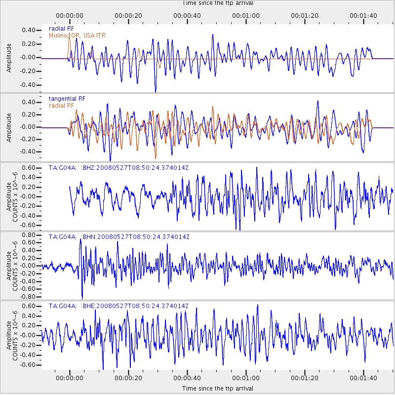
G04A Mulino, OR, USA - Earthquake Result Viewer
*The percent match for this event was below the threshold and hence no stack was calculated.
| Earthquake location: |
Sichuan, China |
| Earthquake latitude/longitude: |
32.7/105.5 |
| Earthquake time(UTC): |
2008/05/27 (148) 08:37:51 GMT |
| Earthquake Depth: |
10 km |
| Earthquake Magnitude: |
5.5 MB, 5.2 MS, 5.7 MW, 5.5 MW |
| Earthquake Catalog/Contributor: |
WHDF/NEIC |
|
| Network: |
TA USArray Transportable Network (new EarthScope stations) |
| Station: |
G04A Mulino, OR, USA |
| Lat/Lon: |
45.21 N/122.48 W |
| Elevation: |
273 m |
|
| Distance: |
91.0 deg |
| Az: |
31.709 deg |
| Baz: |
321.185 deg |
| Ray Param: |
$rayparam |
*The percent match for this event was below the threshold and hence was not used in the summary stack. |
|
| Radial Match: |
53.662003 % |
| Radial Bump: |
400 |
| Transverse Match: |
46.79202 % |
| Transverse Bump: |
400 |
| SOD ConfigId: |
2504 |
| Insert Time: |
2010-03-06 17:42:52.727 +0000 |
| GWidth: |
2.5 |
| Max Bumps: |
400 |
| Tol: |
0.001 |
|
Signal To Noise
| Channel | StoN | STA | LTA |
| TA:G04A: :BHN:20080527T08:50:24.374014Z | 3.3207371 | 2.8749068E-7 | 8.657436E-8 |
| TA:G04A: :BHE:20080527T08:50:24.374014Z | 1.0007308 | 1.2467072E-7 | 1.2457967E-7 |
| TA:G04A: :BHZ:20080527T08:50:24.374014Z | 0.5119769 | 9.048661E-8 | 1.7673963E-7 |
| Arrivals |
| Ps | |
| PpPs | |
| PsPs/PpSs | |


