You are here: Home > Network List > G - GEOSCOPE Stations List
> Station MPG Montagne des Peres, French Guyana > Earthquake Result Viewer
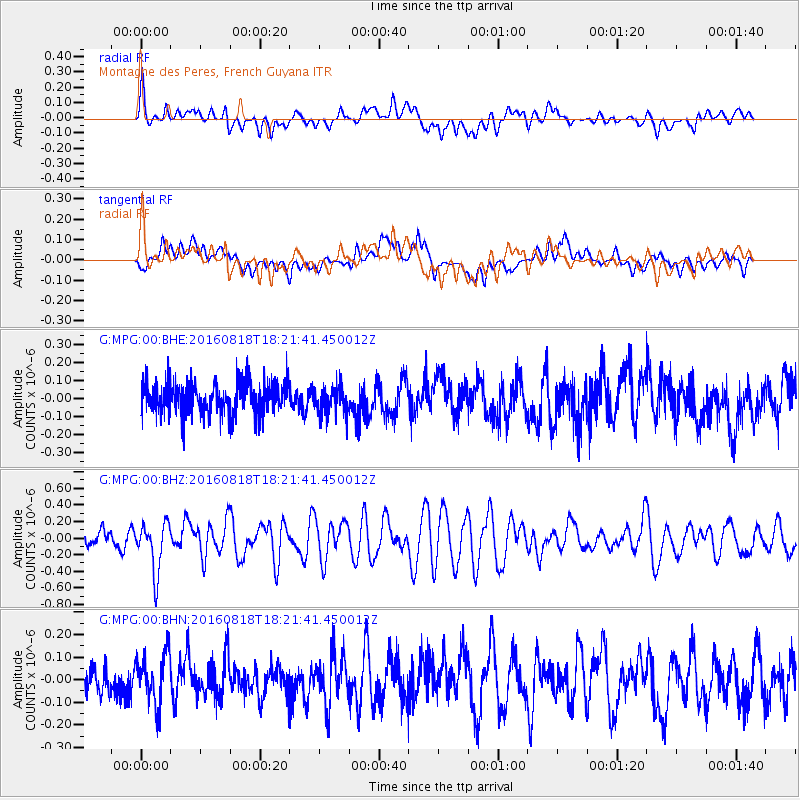
MPG Montagne des Peres, French Guyana - Earthquake Result Viewer
*The percent match for this event was below the threshold and hence no stack was calculated.
| Earthquake location: |
Southern East Pacific Rise |
| Earthquake latitude/longitude: |
-56.0/-123.2 |
| Earthquake time(UTC): |
2016/08/18 (231) 18:09:45 GMT |
| Earthquake Depth: |
9.5 km |
| Earthquake Magnitude: |
5.5 MB |
| Earthquake Catalog/Contributor: |
NEIC PDE/NEIC ALERT |
|
| Network: |
G GEOSCOPE |
| Station: |
MPG Montagne des Peres, French Guyana |
| Lat/Lon: |
5.11 N/52.64 W |
| Elevation: |
147 m |
|
| Distance: |
83.5 deg |
| Az: |
70.965 deg |
| Baz: |
212.256 deg |
| Ray Param: |
$rayparam |
*The percent match for this event was below the threshold and hence was not used in the summary stack. |
|
| Radial Match: |
67.40335 % |
| Radial Bump: |
400 |
| Transverse Match: |
53.613663 % |
| Transverse Bump: |
400 |
| SOD ConfigId: |
1634031 |
| Insert Time: |
2016-09-01 18:11:40.353 +0000 |
| GWidth: |
2.5 |
| Max Bumps: |
400 |
| Tol: |
0.001 |
|
Signal To Noise
| Channel | StoN | STA | LTA |
| G:MPG:00:BHZ:20160818T18:21:41.450012Z | 2.7565963 | 2.9672765E-7 | 1.0764277E-7 |
| G:MPG:00:BHN:20160818T18:21:41.450012Z | 1.2837507 | 1.10437824E-7 | 8.602748E-8 |
| G:MPG:00:BHE:20160818T18:21:41.450012Z | 0.90144646 | 8.09281E-8 | 8.977583E-8 |
| Arrivals |
| Ps | |
| PpPs | |
| PsPs/PpSs | |


