You are here: Home > Network List > GS - US Geological Survey Networks Stations List
> Station KAN13 Rinehart Farm > Earthquake Result Viewer
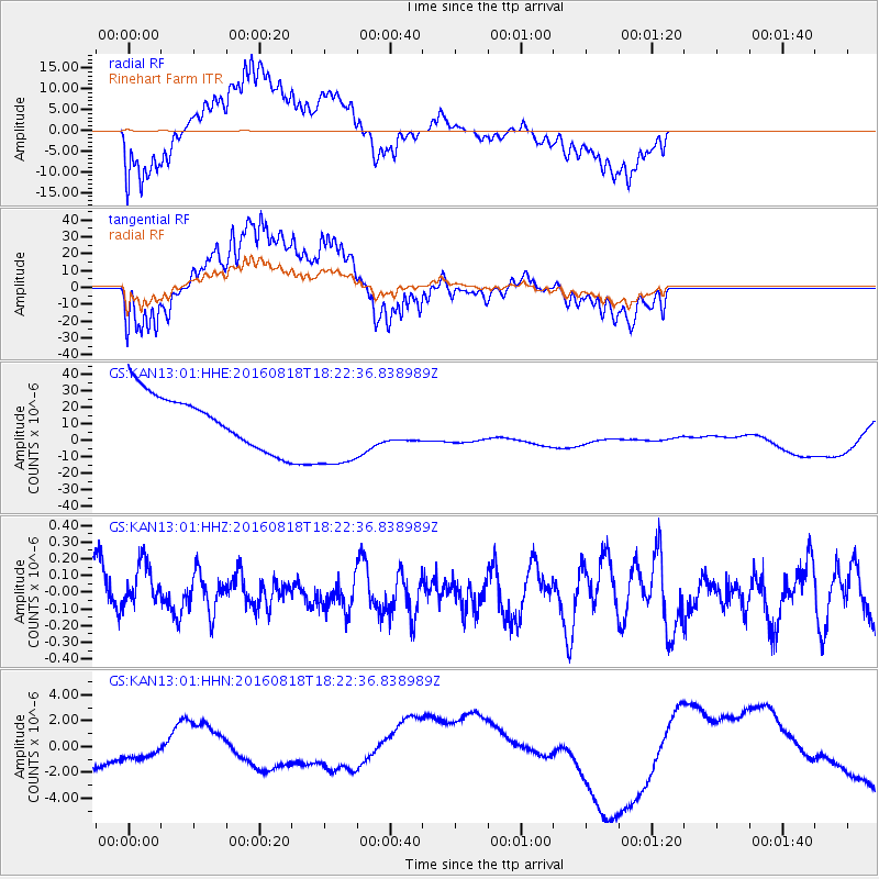
KAN13 Rinehart Farm - Earthquake Result Viewer
*The percent match for this event was below the threshold and hence no stack was calculated.
| Earthquake location: |
Southern East Pacific Rise |
| Earthquake latitude/longitude: |
-56.0/-123.2 |
| Earthquake time(UTC): |
2016/08/18 (231) 18:09:45 GMT |
| Earthquake Depth: |
9.5 km |
| Earthquake Magnitude: |
5.5 MB |
| Earthquake Catalog/Contributor: |
NEIC PDE/NEIC ALERT |
|
| Network: |
GS US Geological Survey Networks |
| Station: |
KAN13 Rinehart Farm |
| Lat/Lon: |
37.01 N/97.48 W |
| Elevation: |
340 m |
|
| Distance: |
95.2 deg |
| Az: |
20.408 deg |
| Baz: |
194.181 deg |
| Ray Param: |
$rayparam |
*The percent match for this event was below the threshold and hence was not used in the summary stack. |
|
| Radial Match: |
67.68957 % |
| Radial Bump: |
400 |
| Transverse Match: |
63.69833 % |
| Transverse Bump: |
400 |
| SOD ConfigId: |
1634031 |
| Insert Time: |
2016-09-01 18:12:05.290 +0000 |
| GWidth: |
2.5 |
| Max Bumps: |
400 |
| Tol: |
0.001 |
|
Signal To Noise
| Channel | StoN | STA | LTA |
| GS:KAN13:01:HHZ:20160818T18:22:36.838989Z | 0.9432118 | 1.4273674E-7 | 1.5133053E-7 |
| GS:KAN13:01:HHN:20160818T18:22:36.838989Z | 1.0504764 | 1.0126439E-6 | 9.639854E-7 |
| GS:KAN13:01:HHE:20160818T18:22:36.838989Z | 1.6503292 | 2.6089645E-5 | 1.5808751E-5 |
| Arrivals |
| Ps | |
| PpPs | |
| PsPs/PpSs | |


