You are here: Home > Network List > TA - USArray Transportable Network (new EarthScope stations) Stations List
> Station Z14A Wintersburg, AZ, USA > Earthquake Result Viewer
Z14A Wintersburg, AZ, USA - Earthquake Result Viewer

| Earthquake location: |
Fiji Islands Region |
| Earthquake latitude/longitude: |
-20.7/-177.4 |
| Earthquake time(UTC): |
2007/10/08 (281) 18:37:53 GMT |
| Earthquake Depth: |
338 km |
| Earthquake Magnitude: |
5.6 MB, 5.7 MW, 5.6 MW |
| Earthquake Catalog/Contributor: |
WHDF/NEIC |
|
| Network: |
TA USArray Transportable Network (new EarthScope stations) |
| Station: |
Z14A Wintersburg, AZ, USA |
| Lat/Lon: |
33.36 N/112.95 W |
| Elevation: |
298 m |
|
| Distance: |
81.6 deg |
| Az: |
49.746 deg |
| Baz: |
238.621 deg |
| Ray Param: |
0.04655288 |
| Estimated Moho Depth: |
19.75 km |
| Estimated Crust Vp/Vs: |
2.06 |
| Assumed Crust Vp: |
6.264 km/s |
| Estimated Crust Vs: |
3.044 km/s |
| Estimated Crust Poisson's Ratio: |
0.35 |
|
| Radial Match: |
83.50384 % |
| Radial Bump: |
400 |
| Transverse Match: |
61.999035 % |
| Transverse Bump: |
400 |
| SOD ConfigId: |
2564 |
| Insert Time: |
2010-03-06 17:44:34.174 +0000 |
| GWidth: |
2.5 |
| Max Bumps: |
400 |
| Tol: |
0.001 |
|
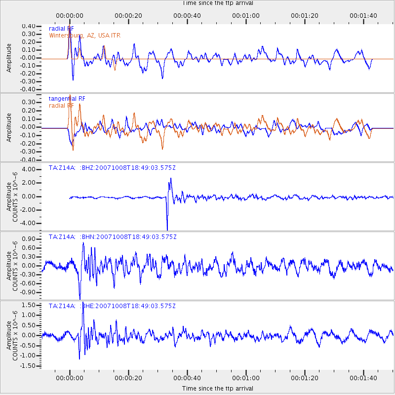
Signal To Noise
| Channel | StoN | STA | LTA |
| TA:Z14A: :BHN:20071008T18:49:03.575Z | 3.5815206 | 4.199371E-7 | 1.1725107E-7 |
| TA:Z14A: :BHE:20071008T18:49:03.575Z | 3.6160502 | 5.2640297E-7 | 1.4557402E-7 |
| TA:Z14A: :BHZ:20071008T18:49:03.575Z | 16.453691 | 1.4265228E-6 | 8.669925E-8 |
| Arrivals |
| Ps | 3.4 SECOND |
| PpPs | 9.4 SECOND |
| PsPs/PpSs | 13 SECOND |


