You are here: Home > Network List > CI - Caltech Regional Seismic Network Stations List
> Station MPM Manuel Prospect Mine, California, USA > Earthquake Result Viewer
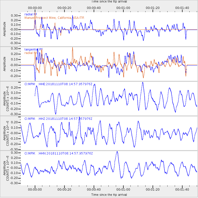
MPM Manuel Prospect Mine, California, USA - Earthquake Result Viewer
*The percent match for this event was below the threshold and hence no stack was calculated.
| Earthquake location: |
New Britain Region, P.N.G. |
| Earthquake latitude/longitude: |
-5.8/151.7 |
| Earthquake time(UTC): |
2018/11/10 (314) 08:02:16 GMT |
| Earthquake Depth: |
52 km |
| Earthquake Magnitude: |
5.7 Mww |
| Earthquake Catalog/Contributor: |
NEIC PDE/us |
|
| Network: |
CI Caltech Regional Seismic Network |
| Station: |
MPM Manuel Prospect Mine, California, USA |
| Lat/Lon: |
36.06 N/117.49 W |
| Elevation: |
185 m |
|
| Distance: |
94.0 deg |
| Az: |
54.313 deg |
| Baz: |
265.781 deg |
| Ray Param: |
$rayparam |
*The percent match for this event was below the threshold and hence was not used in the summary stack. |
|
| Radial Match: |
48.25304 % |
| Radial Bump: |
400 |
| Transverse Match: |
42.292145 % |
| Transverse Bump: |
400 |
| SOD ConfigId: |
13570011 |
| Insert Time: |
2019-05-01 18:53:57.490 +0000 |
| GWidth: |
2.5 |
| Max Bumps: |
400 |
| Tol: |
0.001 |
|
Signal To Noise
| Channel | StoN | STA | LTA |
| CI:MPM: :HHZ:20181110T08:14:57.957976Z | 0.76097 | 6.1982604E-8 | 8.14521E-8 |
| CI:MPM: :HHN:20181110T08:14:57.957976Z | 1.2654898 | 1.2141676E-7 | 9.5944486E-8 |
| CI:MPM: :HHE:20181110T08:14:57.957976Z | 0.8911023 | 9.4676764E-8 | 1.0624679E-7 |
| Arrivals |
| Ps | |
| PpPs | |
| PsPs/PpSs | |


