You are here: Home > Network List > US - United States National Seismic Network Stations List
> Station WMOK Wichita Mountains, Oklahoma, USA > Earthquake Result Viewer
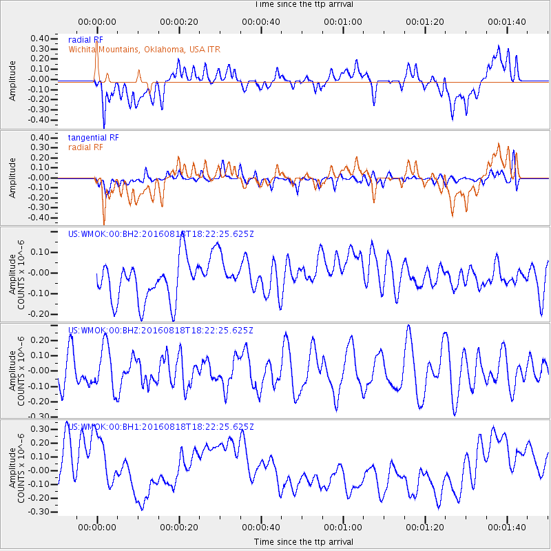
WMOK Wichita Mountains, Oklahoma, USA - Earthquake Result Viewer
*The percent match for this event was below the threshold and hence no stack was calculated.
| Earthquake location: |
Southern East Pacific Rise |
| Earthquake latitude/longitude: |
-56.0/-123.2 |
| Earthquake time(UTC): |
2016/08/18 (231) 18:09:45 GMT |
| Earthquake Depth: |
9.5 km |
| Earthquake Magnitude: |
5.5 MB |
| Earthquake Catalog/Contributor: |
NEIC PDE/NEIC ALERT |
|
| Network: |
US United States National Seismic Network |
| Station: |
WMOK Wichita Mountains, Oklahoma, USA |
| Lat/Lon: |
34.74 N/98.78 W |
| Elevation: |
486 m |
|
| Distance: |
92.7 deg |
| Az: |
19.922 deg |
| Baz: |
193.454 deg |
| Ray Param: |
$rayparam |
*The percent match for this event was below the threshold and hence was not used in the summary stack. |
|
| Radial Match: |
20.521547 % |
| Radial Bump: |
400 |
| Transverse Match: |
40.361374 % |
| Transverse Bump: |
400 |
| SOD ConfigId: |
1634031 |
| Insert Time: |
2016-09-01 18:14:07.345 +0000 |
| GWidth: |
2.5 |
| Max Bumps: |
400 |
| Tol: |
0.001 |
|
Signal To Noise
| Channel | StoN | STA | LTA |
| US:WMOK:00:BHZ:20160818T18:22:25.625Z | 1.3492025 | 1.477627E-7 | 1.0951855E-7 |
| US:WMOK:00:BH1:20160818T18:22:25.625Z | 1.7439024 | 2.7755394E-7 | 1.5915681E-7 |
| US:WMOK:00:BH2:20160818T18:22:25.625Z | 1.038786 | 1.00668984E-7 | 9.691021E-8 |
| Arrivals |
| Ps | |
| PpPs | |
| PsPs/PpSs | |


