Z14A Wintersburg, AZ, USA - Earthquake Result Viewer
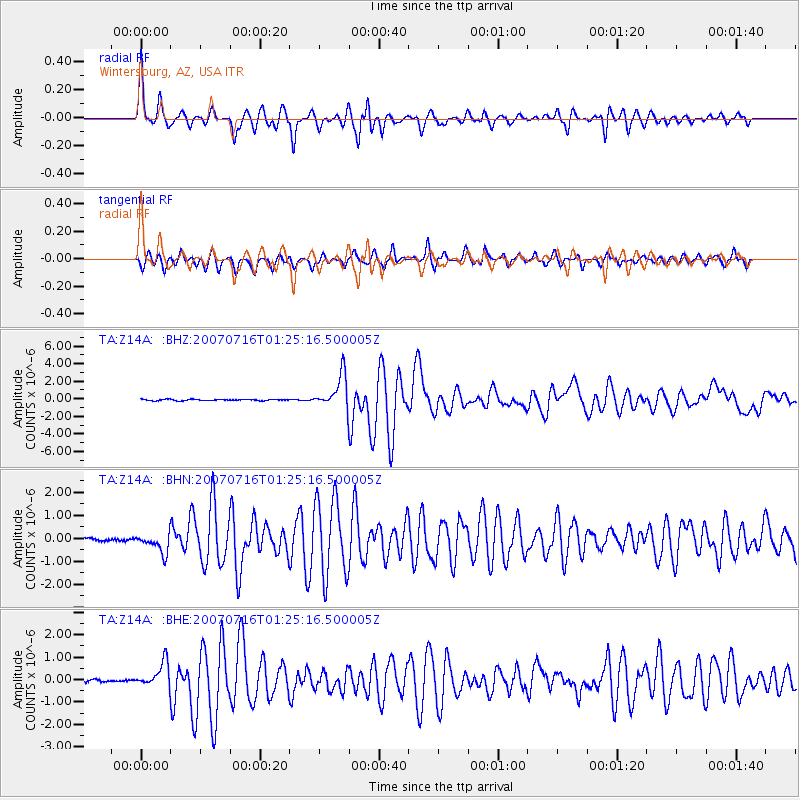
Earthquake location: Near West Coast Of Honshu, Japan
Earthquake latitude/longitude: 37.5/138.4
Earthquake time(UTC): 2007/07/16 (197) 01:13:22 GMT
Earthquake Depth: 12 km
Earthquake Magnitude: 6.5 MB, 6.4 MS, 6.6 MW, 6.5 MW
Earthquake Catalog/Contributor: WHDF/NEIC
Network: TA USArray Transportable Network (new EarthScope stations)
Station: Z14A Wintersburg, AZ, USA
Lat/Lon: 33.36 N/112.95 W
Elevation: 298 m
Distance: 83.1 deg
Az: 53.025 deg
Baz: 310.636 deg
Ray Param: 0.04640931
Estimated Moho Depth: 29.5 km
Estimated Crust Vp/Vs: 1.70
Assumed Crust Vp: 6.264 km/s
Estimated Crust Vs: 3.679 km/s
Estimated Crust Poisson's Ratio: 0.24
Radial Match: 95.186554 %
Radial Bump: 338
Transverse Match: 77.89466 %
Transverse Bump: 400
SOD ConfigId: 2564
Insert Time: 2010-03-06 17:45:18.433 +0000
GWidth: 2.5
Max Bumps: 400
Tol: 0.001

Signal To Noise

ChannelStoNSTALTA
TA:Z14A: :BHN:20070716T01:25:16.500005Z7.72613574.240737E-75.48882E-8
TA:Z14A: :BHE:20070716T01:25:16.500005Z7.6373675.448428E-77.1339095E-8
TA:Z14A: :BHZ:20070716T01:25:16.500005Z26.2844771.932404E-67.3518834E-8
Arrivals
Ps3.4 SECOND
PpPs12 SECOND
PsPs/PpSs16 SECOND