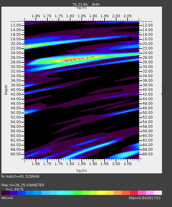
Z14A Wintersburg, AZ, USA - Earthquake Result Viewer
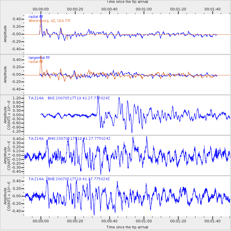
Earthquake location: Kermadec Islands, New Zealand
Earthquake latitude/longitude: -30.7/-178.2
Earthquake time(UTC): 2007/05/17 (137) 19:29:10 GMT
Earthquake Depth: 41 km
Earthquake Magnitude: 5.5 MB, 5.6 MS, 6.0 MW, 5.9 MW
Earthquake Catalog/Contributor: WHDF/NEIC
Network: TA USArray Transportable Network (new EarthScope stations)
Station: Z14A Wintersburg, AZ, USA
Lat/Lon: 33.36 N/112.95 W
Elevation: 298 m
Distance: 88.6 deg
Az: 49.489 deg
Baz: 231.521 deg
Ray Param: 0.042392917
Estimated Moho Depth: 26.25 km
Estimated Crust Vp/Vs: 1.85
Assumed Crust Vp: 6.264 km/s
Estimated Crust Vs: 3.39 km/s
Estimated Crust Poisson's Ratio: 0.29
Radial Match: 91.528946 %
Radial Bump: 400
Transverse Match: 68.37426 %
Transverse Bump: 400
SOD ConfigId: 2564
Insert Time: 2010-03-06 17:45:41.867 +0000
GWidth: 2.5
Max Bumps: 400
Tol: 0.001

Signal To Noise

ChannelStoNSTALTA
TA:Z14A: :BHN:20070517T19:41:27.775024Z1.9155271.4404442E-77.519833E-8
TA:Z14A: :BHE:20070517T19:41:27.775024Z3.55220721.9507856E-75.4917564E-8
TA:Z14A: :BHZ:20070517T19:41:27.775024Z6.2561985.04497E-78.063955E-8
Arrivals
Ps3.6 SECOND
PpPs12 SECOND
PsPs/PpSs15 SECOND