You are here: Home > Network List > TA - USArray Transportable Network (new EarthScope stations) Stations List
> Station R33M Jennings River, BC, CAN > Earthquake Result Viewer
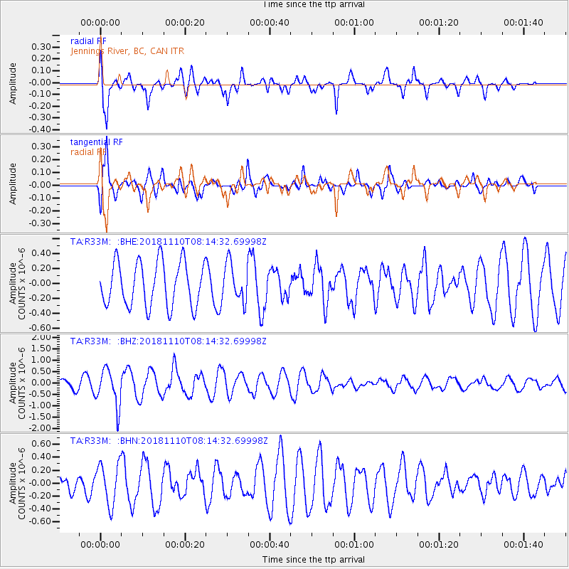
R33M Jennings River, BC, CAN - Earthquake Result Viewer
*The percent match for this event was below the threshold and hence no stack was calculated.
| Earthquake location: |
New Britain Region, P.N.G. |
| Earthquake latitude/longitude: |
-5.8/151.7 |
| Earthquake time(UTC): |
2018/11/10 (314) 08:02:16 GMT |
| Earthquake Depth: |
52 km |
| Earthquake Magnitude: |
5.7 Mww |
| Earthquake Catalog/Contributor: |
NEIC PDE/us |
|
| Network: |
TA USArray Transportable Network (new EarthScope stations) |
| Station: |
R33M Jennings River, BC, CAN |
| Lat/Lon: |
59.39 N/130.97 W |
| Elevation: |
1437 m |
|
| Distance: |
88.5 deg |
| Az: |
29.955 deg |
| Baz: |
256.157 deg |
| Ray Param: |
$rayparam |
*The percent match for this event was below the threshold and hence was not used in the summary stack. |
|
| Radial Match: |
67.272705 % |
| Radial Bump: |
400 |
| Transverse Match: |
77.22944 % |
| Transverse Bump: |
400 |
| SOD ConfigId: |
13570011 |
| Insert Time: |
2019-05-01 18:58:26.925 +0000 |
| GWidth: |
2.5 |
| Max Bumps: |
400 |
| Tol: |
0.001 |
|
Signal To Noise
| Channel | StoN | STA | LTA |
| TA:R33M: :BHZ:20181110T08:14:32.69998Z | 3.4486976 | 8.1402686E-7 | 2.3603893E-7 |
| TA:R33M: :BHN:20181110T08:14:32.69998Z | 2.470581 | 3.2920985E-7 | 1.33252E-7 |
| TA:R33M: :BHE:20181110T08:14:32.69998Z | 0.8584982 | 2.5554775E-7 | 2.9766838E-7 |
| Arrivals |
| Ps | |
| PpPs | |
| PsPs/PpSs | |


