You are here: Home > Network List > AV - Alaska Volcano Observatory Stations List
> Station SPCR Ckakachatna River, Mount Spurr, Alaska > Earthquake Result Viewer
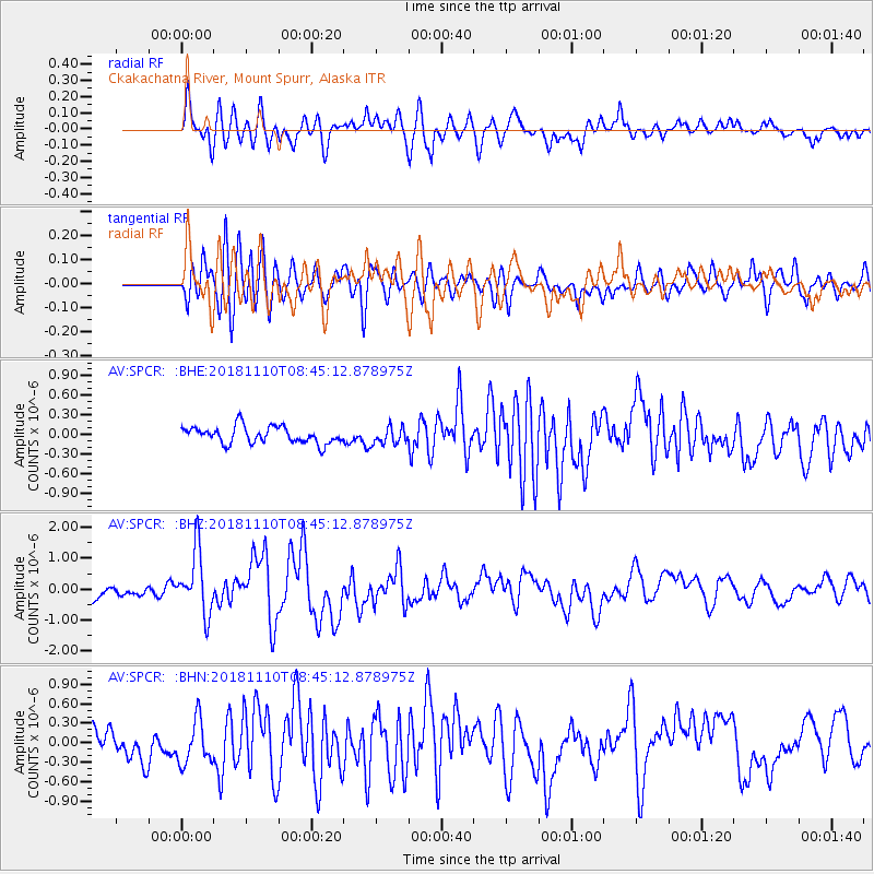
SPCR Ckakachatna River, Mount Spurr, Alaska - Earthquake Result Viewer
*The percent match for this event was below the threshold and hence no stack was calculated.
| Earthquake location: |
Tonga Islands |
| Earthquake latitude/longitude: |
-20.5/-173.8 |
| Earthquake time(UTC): |
2018/11/10 (314) 08:33:16 GMT |
| Earthquake Depth: |
10 km |
| Earthquake Magnitude: |
6.2 Mww |
| Earthquake Catalog/Contributor: |
NEIC PDE/us |
|
| Network: |
AV Alaska Volcano Observatory |
| Station: |
SPCR Ckakachatna River, Mount Spurr, Alaska |
| Lat/Lon: |
61.20 N/152.21 W |
| Elevation: |
984 m |
|
| Distance: |
83.3 deg |
| Az: |
10.345 deg |
| Baz: |
200.337 deg |
| Ray Param: |
$rayparam |
*The percent match for this event was below the threshold and hence was not used in the summary stack. |
|
| Radial Match: |
72.847855 % |
| Radial Bump: |
400 |
| Transverse Match: |
79.49133 % |
| Transverse Bump: |
400 |
| SOD ConfigId: |
13570011 |
| Insert Time: |
2019-05-01 19:02:34.075 +0000 |
| GWidth: |
2.5 |
| Max Bumps: |
400 |
| Tol: |
0.001 |
|
Signal To Noise
| Channel | StoN | STA | LTA |
| AV:SPCR: :BHZ:20181110T08:45:12.878975Z | 5.437871 | 1.0088453E-6 | 1.855221E-7 |
| AV:SPCR: :BHN:20181110T08:45:12.878975Z | 1.1377461 | 3.2886967E-7 | 2.8905365E-7 |
| AV:SPCR: :BHE:20181110T08:45:12.878975Z | 1.0954574 | 1.442038E-7 | 1.3163796E-7 |
| Arrivals |
| Ps | |
| PpPs | |
| PsPs/PpSs | |


