You are here: Home > Network List > TS - TERRAscope (Southern California Seismic Network) Stations List
> Station BAR Barrett Dam, California, USA > Earthquake Result Viewer
BAR Barrett Dam, California, USA - Earthquake Result Viewer
*The percent match for this event was below the threshold and hence no stack was calculated.
| Earthquake location: |
Kermadec Islands Region |
| Earthquake latitude/longitude: |
-28.5/-176.8 |
| Earthquake time(UTC): |
1993/06/18 (169) 17:57:48 GMT |
| Earthquake Depth: |
20 km |
| Earthquake Magnitude: |
5.9 MB, 6.7 MS, 6.6 UNKNOWN, 6.6 MW |
| Earthquake Catalog/Contributor: |
WHDF/NEIC |
|
| Network: |
TS TERRAscope (Southern California Seismic Network) |
| Station: |
BAR Barrett Dam, California, USA |
| Lat/Lon: |
32.68 N/116.67 W |
| Elevation: |
548 m |
|
| Distance: |
83.5 deg |
| Az: |
47.427 deg |
| Baz: |
230.201 deg |
| Ray Param: |
$rayparam |
*The percent match for this event was below the threshold and hence was not used in the summary stack. |
|
| Radial Match: |
38.897614 % |
| Radial Bump: |
400 |
| Transverse Match: |
53.25947 % |
| Transverse Bump: |
400 |
| SOD ConfigId: |
4480 |
| Insert Time: |
2010-02-26 14:00:23.148 +0000 |
| GWidth: |
2.5 |
| Max Bumps: |
400 |
| Tol: |
0.001 |
|
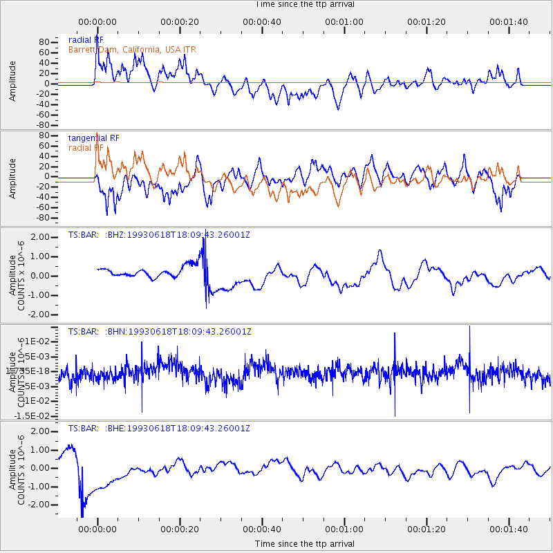
Signal To Noise
| Channel | StoN | STA | LTA |
| TS:BAR: :BHN:19930618T18:09:43.26001Z | 0.8274155 | 2.0142827E-9 | 2.434427E-9 |
| TS:BAR: :BHE:19930618T18:09:43.26001Z | 4.5740747 | 1.4354542E-6 | 3.1382396E-7 |
| TS:BAR: :BHZ:19930618T18:09:43.26001Z | 3.1928437 | 8.476432E-7 | 2.6548224E-7 |
| Arrivals |
| Ps | |
| PpPs | |
| PsPs/PpSs | |


