You are here: Home > Network List > CI - Caltech Regional Seismic Network Stations List
> Station DAN Danby, California, USA > Earthquake Result Viewer
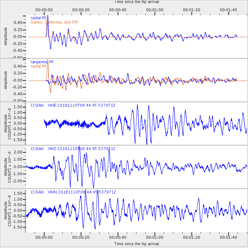
DAN Danby, California, USA - Earthquake Result Viewer
*The percent match for this event was below the threshold and hence no stack was calculated.
| Earthquake location: |
Tonga Islands |
| Earthquake latitude/longitude: |
-20.5/-173.8 |
| Earthquake time(UTC): |
2018/11/10 (314) 08:33:16 GMT |
| Earthquake Depth: |
10 km |
| Earthquake Magnitude: |
6.2 Mww |
| Earthquake Catalog/Contributor: |
NEIC PDE/us |
|
| Network: |
CI Caltech Regional Seismic Network |
| Station: |
DAN Danby, California, USA |
| Lat/Lon: |
34.64 N/115.38 W |
| Elevation: |
398 m |
|
| Distance: |
78.0 deg |
| Az: |
45.903 deg |
| Baz: |
234.717 deg |
| Ray Param: |
$rayparam |
*The percent match for this event was below the threshold and hence was not used in the summary stack. |
|
| Radial Match: |
91.33419 % |
| Radial Bump: |
400 |
| Transverse Match: |
79.581505 % |
| Transverse Bump: |
400 |
| SOD ConfigId: |
13570011 |
| Insert Time: |
2019-05-01 19:03:59.362 +0000 |
| GWidth: |
2.5 |
| Max Bumps: |
400 |
| Tol: |
0.001 |
|
Signal To Noise
| Channel | StoN | STA | LTA |
| CI:DAN: :HHZ:20181110T08:44:45.537971Z | 1.5451057 | 1.7300155E-7 | 1.1196746E-7 |
| CI:DAN: :HHN:20181110T08:44:45.537971Z | 0.71299386 | 1.8159737E-7 | 2.5469694E-7 |
| CI:DAN: :HHE:20181110T08:44:45.537971Z | 1.0986027 | 1.9374936E-7 | 1.763598E-7 |
| Arrivals |
| Ps | |
| PpPs | |
| PsPs/PpSs | |


