You are here: Home > Network List > CI - Caltech Regional Seismic Network Stations List
> Station MPM Manuel Prospect Mine, California, USA > Earthquake Result Viewer
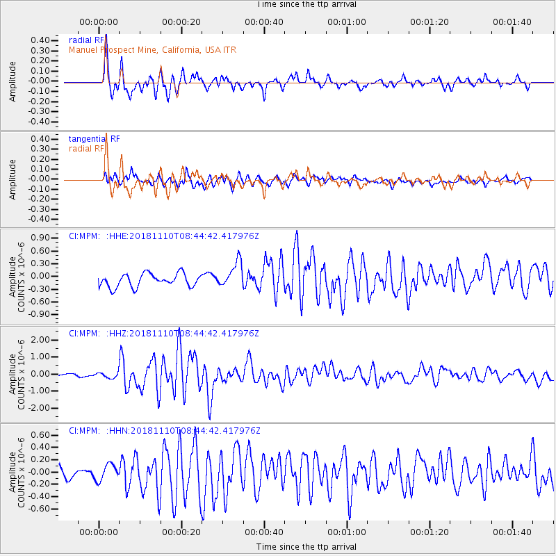
MPM Manuel Prospect Mine, California, USA - Earthquake Result Viewer
*The percent match for this event was below the threshold and hence no stack was calculated.
| Earthquake location: |
Tonga Islands |
| Earthquake latitude/longitude: |
-20.5/-173.8 |
| Earthquake time(UTC): |
2018/11/10 (314) 08:33:16 GMT |
| Earthquake Depth: |
10 km |
| Earthquake Magnitude: |
6.2 Mww |
| Earthquake Catalog/Contributor: |
NEIC PDE/us |
|
| Network: |
CI Caltech Regional Seismic Network |
| Station: |
MPM Manuel Prospect Mine, California, USA |
| Lat/Lon: |
36.06 N/117.49 W |
| Elevation: |
185 m |
|
| Distance: |
77.5 deg |
| Az: |
43.692 deg |
| Baz: |
233.033 deg |
| Ray Param: |
$rayparam |
*The percent match for this event was below the threshold and hence was not used in the summary stack. |
|
| Radial Match: |
87.514656 % |
| Radial Bump: |
400 |
| Transverse Match: |
73.47256 % |
| Transverse Bump: |
400 |
| SOD ConfigId: |
13570011 |
| Insert Time: |
2019-05-01 19:04:25.050 +0000 |
| GWidth: |
2.5 |
| Max Bumps: |
400 |
| Tol: |
0.001 |
|
Signal To Noise
| Channel | StoN | STA | LTA |
| CI:MPM: :HHZ:20181110T08:44:42.417976Z | 0.9920238 | 1.7204917E-7 | 1.734325E-7 |
| CI:MPM: :HHN:20181110T08:44:42.417976Z | 1.0355152 | 1.3360065E-7 | 1.2901853E-7 |
| CI:MPM: :HHE:20181110T08:44:42.417976Z | 0.9558839 | 1.5215461E-7 | 1.5917688E-7 |
| Arrivals |
| Ps | |
| PpPs | |
| PsPs/PpSs | |


