You are here: Home > Network List > CI - Caltech Regional Seismic Network Stations List
> Station MPP McPhearson Peak > Earthquake Result Viewer
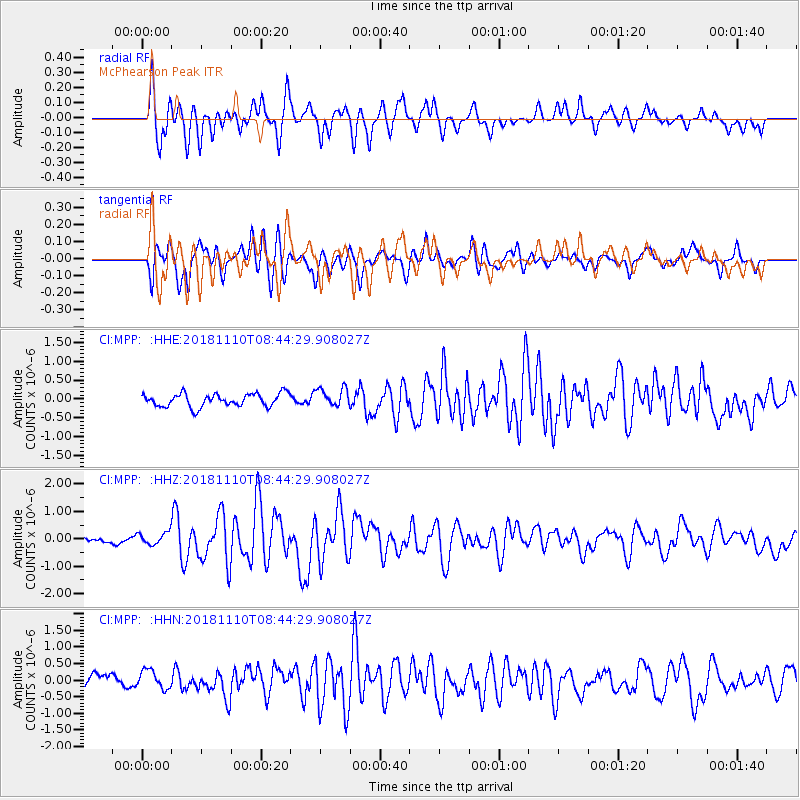
MPP McPhearson Peak - Earthquake Result Viewer
*The percent match for this event was below the threshold and hence no stack was calculated.
| Earthquake location: |
Tonga Islands |
| Earthquake latitude/longitude: |
-20.5/-173.8 |
| Earthquake time(UTC): |
2018/11/10 (314) 08:33:16 GMT |
| Earthquake Depth: |
10 km |
| Earthquake Magnitude: |
6.2 Mww |
| Earthquake Catalog/Contributor: |
NEIC PDE/us |
|
| Network: |
CI Caltech Regional Seismic Network |
| Station: |
MPP McPhearson Peak |
| Lat/Lon: |
34.89 N/119.81 W |
| Elevation: |
1739 m |
|
| Distance: |
75.3 deg |
| Az: |
43.449 deg |
| Baz: |
231.633 deg |
| Ray Param: |
$rayparam |
*The percent match for this event was below the threshold and hence was not used in the summary stack. |
|
| Radial Match: |
76.19751 % |
| Radial Bump: |
400 |
| Transverse Match: |
62.042038 % |
| Transverse Bump: |
400 |
| SOD ConfigId: |
13570011 |
| Insert Time: |
2019-05-01 19:04:25.896 +0000 |
| GWidth: |
2.5 |
| Max Bumps: |
400 |
| Tol: |
0.001 |
|
Signal To Noise
| Channel | StoN | STA | LTA |
| CI:MPP: :HHZ:20181110T08:44:29.908027Z | 1.3994426 | 2.2440236E-7 | 1.6035123E-7 |
| CI:MPP: :HHN:20181110T08:44:29.908027Z | 1.3920817 | 2.891201E-7 | 2.0768901E-7 |
| CI:MPP: :HHE:20181110T08:44:29.908027Z | 1.2299438 | 1.9728371E-7 | 1.6040059E-7 |
| Arrivals |
| Ps | |
| PpPs | |
| PsPs/PpSs | |


