You are here: Home > Network List > CI - Caltech Regional Seismic Network Stations List
> Station SMM Simmler, CA, USA > Earthquake Result Viewer
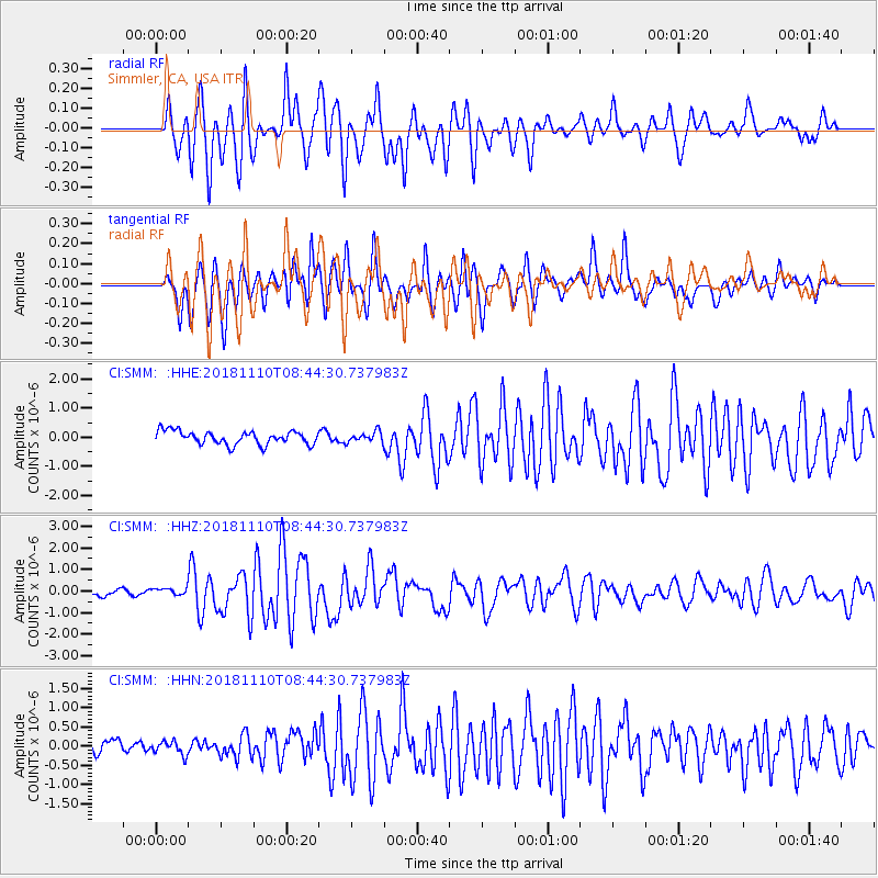
SMM Simmler, CA, USA - Earthquake Result Viewer
*The percent match for this event was below the threshold and hence no stack was calculated.
| Earthquake location: |
Tonga Islands |
| Earthquake latitude/longitude: |
-20.5/-173.8 |
| Earthquake time(UTC): |
2018/11/10 (314) 08:33:16 GMT |
| Earthquake Depth: |
10 km |
| Earthquake Magnitude: |
6.2 Mww |
| Earthquake Catalog/Contributor: |
NEIC PDE/us |
|
| Network: |
CI Caltech Regional Seismic Network |
| Station: |
SMM Simmler, CA, USA |
| Lat/Lon: |
35.31 N/120.00 W |
| Elevation: |
599 m |
|
| Distance: |
75.4 deg |
| Az: |
43.009 deg |
| Baz: |
231.417 deg |
| Ray Param: |
$rayparam |
*The percent match for this event was below the threshold and hence was not used in the summary stack. |
|
| Radial Match: |
79.83878 % |
| Radial Bump: |
400 |
| Transverse Match: |
76.49949 % |
| Transverse Bump: |
400 |
| SOD ConfigId: |
13570011 |
| Insert Time: |
2019-05-01 19:04:37.583 +0000 |
| GWidth: |
2.5 |
| Max Bumps: |
400 |
| Tol: |
0.001 |
|
Signal To Noise
| Channel | StoN | STA | LTA |
| CI:SMM: :HHZ:20181110T08:44:30.737983Z | 1.111985 | 1.6836913E-7 | 1.5141313E-7 |
| CI:SMM: :HHN:20181110T08:44:30.737983Z | 0.9008871 | 1.7134877E-7 | 1.9020005E-7 |
| CI:SMM: :HHE:20181110T08:44:30.737983Z | 0.5784991 | 1.3015917E-7 | 2.249946E-7 |
| Arrivals |
| Ps | |
| PpPs | |
| PsPs/PpSs | |


