You are here: Home > Network List > CN - Canadian National Seismograph Network Stations List
> Station INK INUVIK, NT > Earthquake Result Viewer
INK INUVIK, NT - Earthquake Result Viewer
*The percent match for this event was below the threshold and hence no stack was calculated.
| Earthquake location: |
Tonga Islands |
| Earthquake latitude/longitude: |
-20.5/-173.8 |
| Earthquake time(UTC): |
2018/11/10 (314) 08:33:16 GMT |
| Earthquake Depth: |
10 km |
| Earthquake Magnitude: |
6.2 Mww |
| Earthquake Catalog/Contributor: |
NEIC PDE/us |
|
| Network: |
CN Canadian National Seismograph Network |
| Station: |
INK INUVIK, NT |
| Lat/Lon: |
68.31 N/133.53 W |
| Elevation: |
44 m |
|
| Distance: |
93.3 deg |
| Az: |
13.936 deg |
| Baz: |
217.382 deg |
| Ray Param: |
$rayparam |
*The percent match for this event was below the threshold and hence was not used in the summary stack. |
|
| Radial Match: |
65.20987 % |
| Radial Bump: |
313 |
| Transverse Match: |
62.13305 % |
| Transverse Bump: |
400 |
| SOD ConfigId: |
13570011 |
| Insert Time: |
2019-05-01 19:04:52.415 +0000 |
| GWidth: |
2.5 |
| Max Bumps: |
400 |
| Tol: |
0.001 |
|
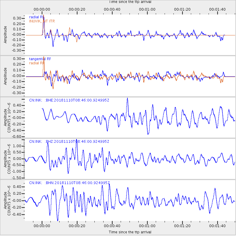
Signal To Noise
| Channel | StoN | STA | LTA |
| CN:INK: :BHZ:20181110T08:46:00.924995Z | 4.2809443 | 5.610661E-7 | 1.310613E-7 |
| CN:INK: :BHN:20181110T08:46:00.924995Z | 1.8009458 | 1.8130372E-7 | 1.0067139E-7 |
| CN:INK: :BHE:20181110T08:46:00.924995Z | 1.1005619 | 1.20113E-7 | 1.0913788E-7 |
| Arrivals |
| Ps | |
| PpPs | |
| PsPs/PpSs | |


