Z14A Wintersburg, AZ, USA - Earthquake Result Viewer
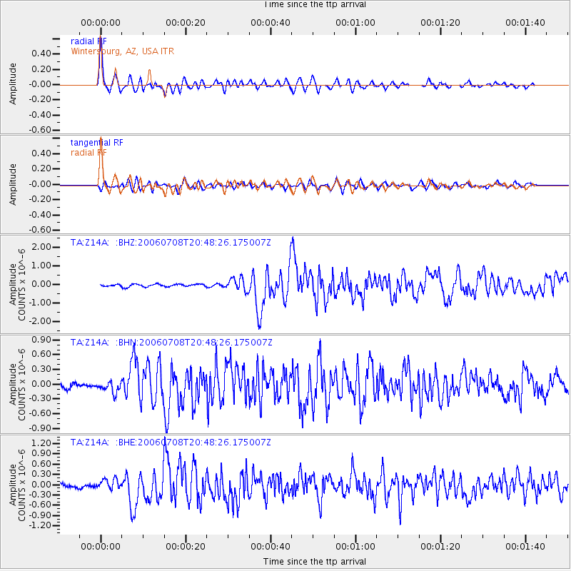
Earthquake location: Andreanof Islands, Aleutian Is.
Earthquake latitude/longitude: 51.2/-179.3
Earthquake time(UTC): 2006/07/08 (189) 20:40:00 GMT
Earthquake Depth: 22 km
Earthquake Magnitude: 6.2 MB, 6.4 MS, 6.6 MW, 6.6 MW
Earthquake Catalog/Contributor: WHDF/NEIC
Network: TA USArray Transportable Network (new EarthScope stations)
Station: Z14A Wintersburg, AZ, USA
Lat/Lon: 33.36 N/112.95 W
Elevation: 298 m
Distance: 50.5 deg
Az: 83.789 deg
Baz: 311.657 deg
Ray Param: 0.06800755
Estimated Moho Depth: 53.5 km
Estimated Crust Vp/Vs: 1.76
Assumed Crust Vp: 6.264 km/s
Estimated Crust Vs: 3.549 km/s
Estimated Crust Poisson's Ratio: 0.26
Radial Match: 89.02444 %
Radial Bump: 400
Transverse Match: 71.67628 %
Transverse Bump: 400
SOD ConfigId: 2665
Insert Time: 2010-03-06 17:48:21.665 +0000
GWidth: 2.5
Max Bumps: 400
Tol: 0.001

Signal To Noise

ChannelStoNSTALTA
TA:Z14A: :BHN:20060708T20:48:26.175007Z1.5556441.15631586E-77.4330366E-8
TA:Z14A: :BHE:20060708T20:48:26.175007Z2.54485821.6335672E-76.419089E-8
TA:Z14A: :BHZ:20060708T20:48:26.175007Z5.02188633.3928092E-76.756046E-8
Arrivals
Ps6.9 SECOND
PpPs22 SECOND
PsPs/PpSs29 SECOND