You are here: Home > Network List > IW - Intermountain West Stations List
> Station MOOW Moose Ponds, Wyoming, USA > Earthquake Result Viewer
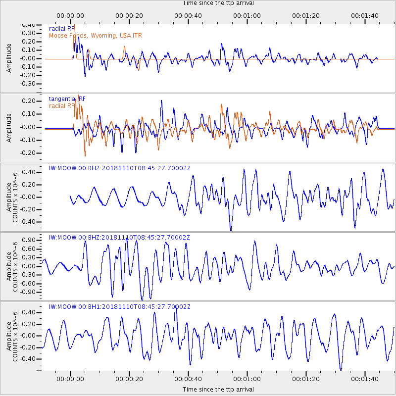
MOOW Moose Ponds, Wyoming, USA - Earthquake Result Viewer
*The percent match for this event was below the threshold and hence no stack was calculated.
| Earthquake location: |
Tonga Islands |
| Earthquake latitude/longitude: |
-20.5/-173.8 |
| Earthquake time(UTC): |
2018/11/10 (314) 08:33:16 GMT |
| Earthquake Depth: |
10 km |
| Earthquake Magnitude: |
6.2 Mww |
| Earthquake Catalog/Contributor: |
NEIC PDE/us |
|
| Network: |
IW Intermountain West |
| Station: |
MOOW Moose Ponds, Wyoming, USA |
| Lat/Lon: |
43.75 N/110.74 W |
| Elevation: |
2128 m |
|
| Distance: |
86.1 deg |
| Az: |
40.361 deg |
| Baz: |
236.88 deg |
| Ray Param: |
$rayparam |
*The percent match for this event was below the threshold and hence was not used in the summary stack. |
|
| Radial Match: |
78.75537 % |
| Radial Bump: |
400 |
| Transverse Match: |
69.24855 % |
| Transverse Bump: |
400 |
| SOD ConfigId: |
13570011 |
| Insert Time: |
2019-05-01 19:06:06.960 +0000 |
| GWidth: |
2.5 |
| Max Bumps: |
400 |
| Tol: |
0.001 |
|
Signal To Noise
| Channel | StoN | STA | LTA |
| IW:MOOW:00:BHZ:20181110T08:45:27.70002Z | 2.1049867 | 2.1924457E-7 | 1.0415485E-7 |
| IW:MOOW:00:BH1:20181110T08:45:27.70002Z | 1.0097026 | 9.763258E-8 | 9.669439E-8 |
| IW:MOOW:00:BH2:20181110T08:45:27.70002Z | 0.9594105 | 8.9368E-8 | 9.314887E-8 |
| Arrivals |
| Ps | |
| PpPs | |
| PsPs/PpSs | |


