You are here: Home > Network List > TS - TERRAscope (Southern California Seismic Network) Stations List
> Station BAR Barrett Dam, California, USA > Earthquake Result Viewer
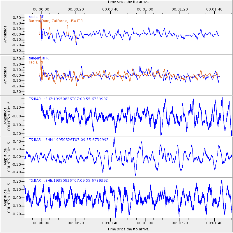
BAR Barrett Dam, California, USA - Earthquake Result Viewer
*The percent match for this event was below the threshold and hence no stack was calculated.
| Earthquake location: |
New Ireland Region, P.N.G. |
| Earthquake latitude/longitude: |
-5.8/153.6 |
| Earthquake time(UTC): |
1995/08/26 (238) 06:57:17 GMT |
| Earthquake Depth: |
33 km |
| Earthquake Magnitude: |
5.3 MB, 6.1 MS, 6.0 UNKNOWN, 6.1 MW |
| Earthquake Catalog/Contributor: |
WHDF/NEIC |
|
| Network: |
TS TERRAscope (Southern California Seismic Network) |
| Station: |
BAR Barrett Dam, California, USA |
| Lat/Lon: |
32.68 N/116.67 W |
| Elevation: |
548 m |
|
| Distance: |
92.8 deg |
| Az: |
57.604 deg |
| Baz: |
264.976 deg |
| Ray Param: |
$rayparam |
*The percent match for this event was below the threshold and hence was not used in the summary stack. |
|
| Radial Match: |
50.466038 % |
| Radial Bump: |
400 |
| Transverse Match: |
59.36066 % |
| Transverse Bump: |
400 |
| SOD ConfigId: |
4480 |
| Insert Time: |
2010-02-26 14:00:23.763 +0000 |
| GWidth: |
2.5 |
| Max Bumps: |
400 |
| Tol: |
0.001 |
|
Signal To Noise
| Channel | StoN | STA | LTA |
| TS:BAR: :BHN:19950826T07:09:55.673999Z | 0.7056084 | 6.5320926E-8 | 9.25739E-8 |
| TS:BAR: :BHE:19950826T07:09:55.673999Z | 1.2672348 | 8.8573124E-8 | 6.98948E-8 |
| TS:BAR: :BHZ:19950826T07:09:55.673999Z | 1.4256924 | 7.437586E-8 | 5.216824E-8 |
| Arrivals |
| Ps | |
| PpPs | |
| PsPs/PpSs | |


