You are here: Home > Network List > TA - USArray Transportable Network (new EarthScope stations) Stations List
> Station 833A Chaparral WMA, Artesia Wells, TX, USA > Earthquake Result Viewer
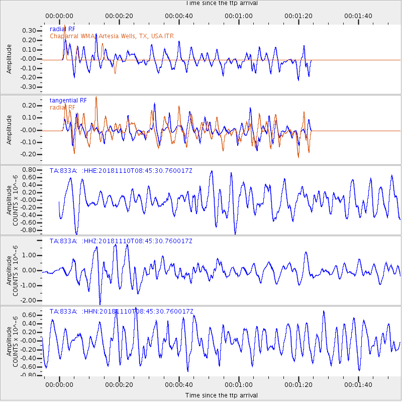
833A Chaparral WMA, Artesia Wells, TX, USA - Earthquake Result Viewer
*The percent match for this event was below the threshold and hence no stack was calculated.
| Earthquake location: |
Tonga Islands |
| Earthquake latitude/longitude: |
-20.5/-173.8 |
| Earthquake time(UTC): |
2018/11/10 (314) 08:33:16 GMT |
| Earthquake Depth: |
10 km |
| Earthquake Magnitude: |
6.2 Mww |
| Earthquake Catalog/Contributor: |
NEIC PDE/us |
|
| Network: |
TA USArray Transportable Network (new EarthScope stations) |
| Station: |
833A Chaparral WMA, Artesia Wells, TX, USA |
| Lat/Lon: |
28.32 N/99.39 W |
| Elevation: |
171 m |
|
| Distance: |
86.7 deg |
| Az: |
58.28 deg |
| Baz: |
244.729 deg |
| Ray Param: |
$rayparam |
*The percent match for this event was below the threshold and hence was not used in the summary stack. |
|
| Radial Match: |
70.96112 % |
| Radial Bump: |
400 |
| Transverse Match: |
59.55563 % |
| Transverse Bump: |
371 |
| SOD ConfigId: |
13570011 |
| Insert Time: |
2019-05-01 19:08:35.915 +0000 |
| GWidth: |
2.5 |
| Max Bumps: |
400 |
| Tol: |
0.001 |
|
Signal To Noise
| Channel | StoN | STA | LTA |
| TA:833A: :HHZ:20181110T08:45:30.760017Z | 1.1885717 | 2.8270046E-7 | 2.3784888E-7 |
| TA:833A: :HHN:20181110T08:45:30.760017Z | 0.8767012 | 1.9275001E-7 | 2.1985826E-7 |
| TA:833A: :HHE:20181110T08:45:30.760017Z | 0.6405362 | 1.9367155E-7 | 3.0235847E-7 |
| Arrivals |
| Ps | |
| PpPs | |
| PsPs/PpSs | |


