Z14A Wintersburg, AZ, USA - Earthquake Result Viewer
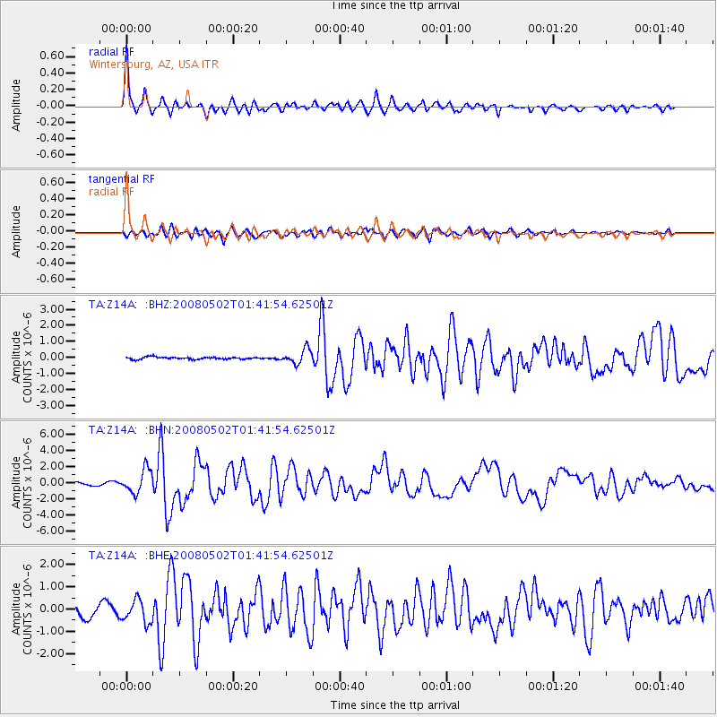
Earthquake location: Andreanof Islands, Aleutian Is.
Earthquake latitude/longitude: 51.9/-177.5
Earthquake time(UTC): 2008/05/02 (123) 01:33:37 GMT
Earthquake Depth: 14 km
Earthquake Magnitude: 6.3 MB, 6.8 MS, 6.6 MW, 6.6 MW
Earthquake Catalog/Contributor: WHDF/NEIC
Network: TA USArray Transportable Network (new EarthScope stations)
Station: Z14A Wintersburg, AZ, USA
Lat/Lon: 33.36 N/112.95 W
Elevation: 298 m
Distance: 49.3 deg
Az: 85.642 deg
Baz: 312.37 deg
Ray Param: 0.068781234
Estimated Moho Depth: 27.5 km
Estimated Crust Vp/Vs: 1.78
Assumed Crust Vp: 6.264 km/s
Estimated Crust Vs: 3.519 km/s
Estimated Crust Poisson's Ratio: 0.27
Radial Match: 93.32706 %
Radial Bump: 400
Transverse Match: 77.91467 %
Transverse Bump: 400
SOD ConfigId: 2504
Insert Time: 2010-03-06 17:49:53.158 +0000
GWidth: 2.5
Max Bumps: 400
Tol: 0.001

Signal To Noise

ChannelStoNSTALTA
TA:Z14A: :BHN:20080502T01:41:54.62501Z8.1883991.4753247E-61.8017252E-7
TA:Z14A: :BHE:20080502T01:41:54.62501Z2.28360185.1588773E-72.2590966E-7
TA:Z14A: :BHZ:20080502T01:41:54.62501Z6.65014744.497752E-76.763387E-8
Arrivals
Ps3.6 SECOND
PpPs12 SECOND
PsPs/PpSs15 SECOND