You are here: Home > Network List > UU - University of Utah Regional Network Stations List
> Station FORU South Mineral Mountains, UT, USA > Earthquake Result Viewer
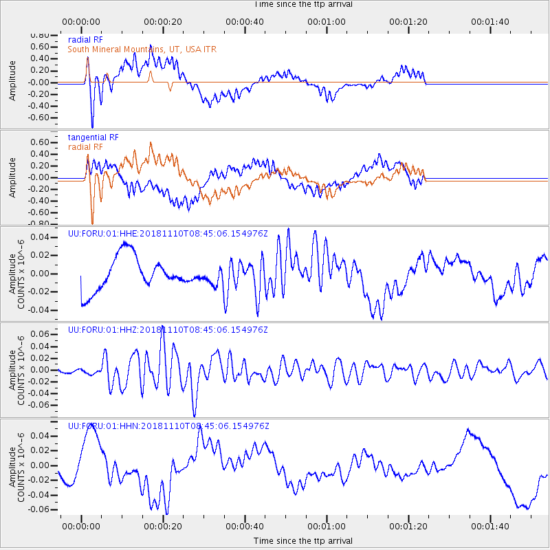
FORU South Mineral Mountains, UT, USA - Earthquake Result Viewer
*The percent match for this event was below the threshold and hence no stack was calculated.
| Earthquake location: |
Tonga Islands |
| Earthquake latitude/longitude: |
-20.5/-173.8 |
| Earthquake time(UTC): |
2018/11/10 (314) 08:33:16 GMT |
| Earthquake Depth: |
10 km |
| Earthquake Magnitude: |
6.2 Mww |
| Earthquake Catalog/Contributor: |
NEIC PDE/us |
|
| Network: |
UU University of Utah Regional Network |
| Station: |
FORU South Mineral Mountains, UT, USA |
| Lat/Lon: |
38.46 N/112.86 W |
| Elevation: |
1840 m |
|
| Distance: |
81.9 deg |
| Az: |
43.893 deg |
| Baz: |
235.861 deg |
| Ray Param: |
$rayparam |
*The percent match for this event was below the threshold and hence was not used in the summary stack. |
|
| Radial Match: |
54.313297 % |
| Radial Bump: |
400 |
| Transverse Match: |
46.17456 % |
| Transverse Bump: |
400 |
| SOD ConfigId: |
13570011 |
| Insert Time: |
2019-05-01 19:12:13.431 +0000 |
| GWidth: |
2.5 |
| Max Bumps: |
400 |
| Tol: |
0.001 |
|
Signal To Noise
| Channel | StoN | STA | LTA |
| UU:FORU:01:HHZ:20181110T08:45:06.154976Z | 0.97129613 | 4.0644252E-9 | 4.1845376E-9 |
| UU:FORU:01:HHN:20181110T08:45:06.154976Z | 1.6422615 | 4.394574E-8 | 2.6759283E-8 |
| UU:FORU:01:HHE:20181110T08:45:06.154976Z | 0.46845618 | 9.076445E-9 | 1.9375229E-8 |
| Arrivals |
| Ps | |
| PpPs | |
| PsPs/PpSs | |


