You are here: Home > Network List > TA - USArray Transportable Network (new EarthScope stations) Stations List
> Station Z14A Wintersburg, AZ, USA > Earthquake Result Viewer
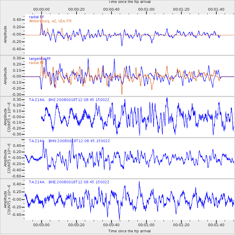
Z14A Wintersburg, AZ, USA - Earthquake Result Viewer
*The percent match for this event was below the threshold and hence no stack was calculated.
| Earthquake location: |
Near East Coast Of Kamchatka |
| Earthquake latitude/longitude: |
51.9/158.4 |
| Earthquake time(UTC): |
2008/09/18 (262) 11:58:50 GMT |
| Earthquake Depth: |
67 km |
| Earthquake Magnitude: |
5.7 MB, 5.9 MW, 5.8 MW |
| Earthquake Catalog/Contributor: |
WHDF/NEIC |
|
| Network: |
TA USArray Transportable Network (new EarthScope stations) |
| Station: |
Z14A Wintersburg, AZ, USA |
| Lat/Lon: |
33.36 N/112.95 W |
| Elevation: |
298 m |
|
| Distance: |
63.8 deg |
| Az: |
68.848 deg |
| Baz: |
316.357 deg |
| Ray Param: |
$rayparam |
*The percent match for this event was below the threshold and hence was not used in the summary stack. |
|
| Radial Match: |
56.420834 % |
| Radial Bump: |
400 |
| Transverse Match: |
70.314995 % |
| Transverse Bump: |
400 |
| SOD ConfigId: |
2504 |
| Insert Time: |
2010-03-06 17:50:53.487 +0000 |
| GWidth: |
2.5 |
| Max Bumps: |
400 |
| Tol: |
0.001 |
|
Signal To Noise
| Channel | StoN | STA | LTA |
| TA:Z14A: :BHN:20080918T12:08:45.15002Z | 2.1611116 | 2.2761807E-7 | 1.0532453E-7 |
| TA:Z14A: :BHE:20080918T12:08:45.15002Z | 0.8362242 | 8.338332E-8 | 9.971407E-8 |
| TA:Z14A: :BHZ:20080918T12:08:45.15002Z | 1.1549383 | 1.1251709E-7 | 9.74226E-8 |
| Arrivals |
| Ps | |
| PpPs | |
| PsPs/PpSs | |


