You are here: Home > Network List > TA - USArray Transportable Network (new EarthScope stations) Stations List
> Station Z14A Wintersburg, AZ, USA > Earthquake Result Viewer
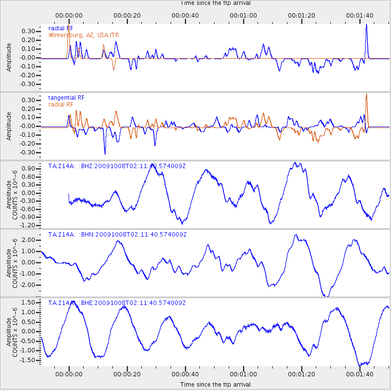
Z14A Wintersburg, AZ, USA - Earthquake Result Viewer
*The percent match for this event was below the threshold and hence no stack was calculated.
| Earthquake location: |
Santa Cruz Islands |
| Earthquake latitude/longitude: |
-11.9/166.0 |
| Earthquake time(UTC): |
2009/10/08 (281) 01:59:19 GMT |
| Earthquake Depth: |
35 km |
| Earthquake Magnitude: |
5.9 MB |
| Earthquake Catalog/Contributor: |
WHDF/NEIC |
|
| Network: |
TA USArray Transportable Network (new EarthScope stations) |
| Station: |
Z14A Wintersburg, AZ, USA |
| Lat/Lon: |
33.36 N/112.95 W |
| Elevation: |
298 m |
|
| Distance: |
89.2 deg |
| Az: |
55.781 deg |
| Baz: |
255.262 deg |
| Ray Param: |
$rayparam |
*The percent match for this event was below the threshold and hence was not used in the summary stack. |
|
| Radial Match: |
56.077335 % |
| Radial Bump: |
400 |
| Transverse Match: |
53.284046 % |
| Transverse Bump: |
400 |
| SOD ConfigId: |
2622 |
| Insert Time: |
2010-03-06 17:51:17.367 +0000 |
| GWidth: |
2.5 |
| Max Bumps: |
400 |
| Tol: |
0.001 |
|
Signal To Noise
| Channel | StoN | STA | LTA |
| TA:Z14A: :BHN:20091008T02:11:40.574009Z | 1.2907741 | 6.343307E-7 | 4.914343E-7 |
| TA:Z14A: :BHE:20091008T02:11:40.574009Z | 3.20016 | 1.534236E-6 | 4.794248E-7 |
| TA:Z14A: :BHZ:20091008T02:11:40.574009Z | 5.414141 | 9.462149E-7 | 1.7476732E-7 |
| Arrivals |
| Ps | |
| PpPs | |
| PsPs/PpSs | |


