You are here: Home > Network List > AV - Alaska Volcano Observatory Stations List
> Station SPCR Ckakachatna River, Mount Spurr, Alaska > Earthquake Result Viewer
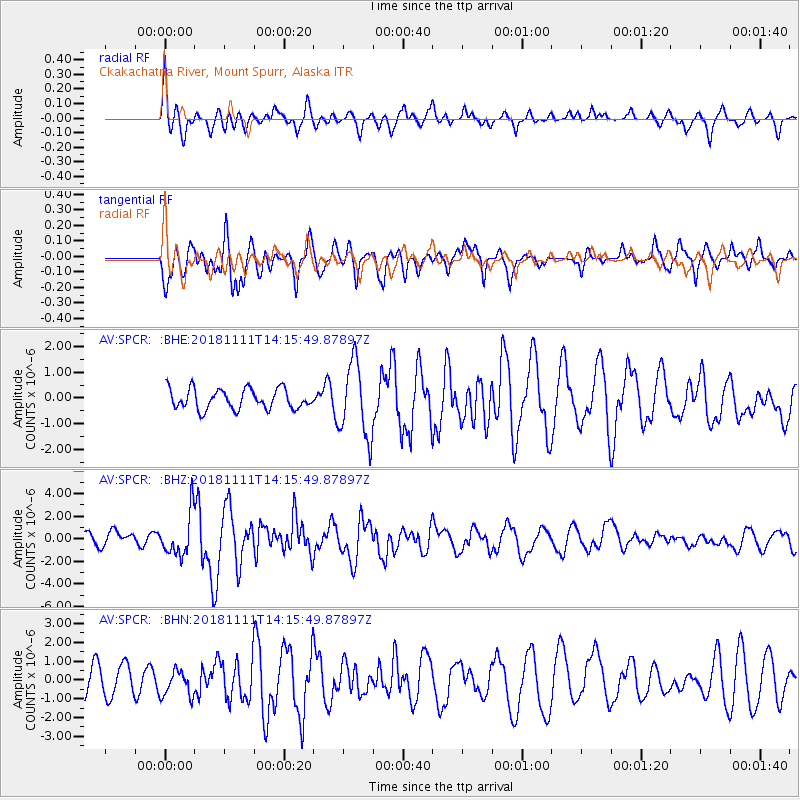
SPCR Ckakachatna River, Mount Spurr, Alaska - Earthquake Result Viewer
*The percent match for this event was below the threshold and hence no stack was calculated.
| Earthquake location: |
North Atlantic Ocean |
| Earthquake latitude/longitude: |
15.6/-49.9 |
| Earthquake time(UTC): |
2018/11/11 (315) 14:03:59 GMT |
| Earthquake Depth: |
10 km |
| Earthquake Magnitude: |
6.2 mb |
| Earthquake Catalog/Contributor: |
NEIC PDE/us |
|
| Network: |
AV Alaska Volcano Observatory |
| Station: |
SPCR Ckakachatna River, Mount Spurr, Alaska |
| Lat/Lon: |
61.20 N/152.21 W |
| Elevation: |
984 m |
|
| Distance: |
82.3 deg |
| Az: |
331.49 deg |
| Baz: |
71.809 deg |
| Ray Param: |
$rayparam |
*The percent match for this event was below the threshold and hence was not used in the summary stack. |
|
| Radial Match: |
68.845894 % |
| Radial Bump: |
400 |
| Transverse Match: |
73.181915 % |
| Transverse Bump: |
400 |
| SOD ConfigId: |
13570011 |
| Insert Time: |
2019-05-01 19:15:35.647 +0000 |
| GWidth: |
2.5 |
| Max Bumps: |
400 |
| Tol: |
0.001 |
|
Signal To Noise
| Channel | StoN | STA | LTA |
| AV:SPCR: :BHZ:20181111T14:15:49.87897Z | 2.9873638 | 1.9038686E-6 | 6.373072E-7 |
| AV:SPCR: :BHN:20181111T14:15:49.87897Z | 0.58212936 | 7.1772405E-7 | 1.2329288E-6 |
| AV:SPCR: :BHE:20181111T14:15:49.87897Z | 3.7242618 | 1.4425233E-6 | 3.8733134E-7 |
| Arrivals |
| Ps | |
| PpPs | |
| PsPs/PpSs | |


