You are here: Home > Network List > TA - USArray Transportable Network (new EarthScope stations) Stations List
> Station Z14A Wintersburg, AZ, USA > Earthquake Result Viewer
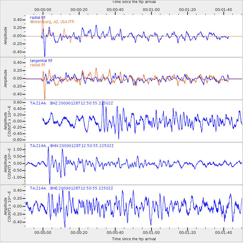
Z14A Wintersburg, AZ, USA - Earthquake Result Viewer
*The percent match for this event was below the threshold and hence no stack was calculated.
| Earthquake location: |
Samoa Islands Region |
| Earthquake latitude/longitude: |
-17.0/-172.1 |
| Earthquake time(UTC): |
2009/01/28 (028) 12:39:42 GMT |
| Earthquake Depth: |
10 km |
| Earthquake Magnitude: |
5.6 MB, 5.3 MS, 5.5 MW |
| Earthquake Catalog/Contributor: |
WHDF/NEIC |
|
| Network: |
TA USArray Transportable Network (new EarthScope stations) |
| Station: |
Z14A Wintersburg, AZ, USA |
| Lat/Lon: |
33.36 N/112.95 W |
| Elevation: |
298 m |
|
| Distance: |
75.4 deg |
| Az: |
47.926 deg |
| Baz: |
238.08 deg |
| Ray Param: |
$rayparam |
*The percent match for this event was below the threshold and hence was not used in the summary stack. |
|
| Radial Match: |
65.65454 % |
| Radial Bump: |
400 |
| Transverse Match: |
63.284206 % |
| Transverse Bump: |
400 |
| SOD ConfigId: |
2658 |
| Insert Time: |
2010-03-06 17:51:58.769 +0000 |
| GWidth: |
2.5 |
| Max Bumps: |
400 |
| Tol: |
0.001 |
|
Signal To Noise
| Channel | StoN | STA | LTA |
| TA:Z14A: :BHN:20090128T12:50:55.22502Z | 6.948892 | 5.34324E-7 | 7.689341E-8 |
| TA:Z14A: :BHE:20090128T12:50:55.22502Z | 1.4415659 | 1.5537178E-7 | 1.0777987E-7 |
| TA:Z14A: :BHZ:20090128T12:50:55.22502Z | 2.0463986 | 2.6067926E-7 | 1.273844E-7 |
| Arrivals |
| Ps | |
| PpPs | |
| PsPs/PpSs | |


