You are here: Home > Network List > CI - Caltech Regional Seismic Network Stations List
> Station SCI2 SCI2, San Clemente Is. (NW tip), CA, USA > Earthquake Result Viewer
SCI2 SCI2, San Clemente Is. (NW tip), CA, USA - Earthquake Result Viewer

| Earthquake location: |
North Atlantic Ocean |
| Earthquake latitude/longitude: |
15.6/-49.9 |
| Earthquake time(UTC): |
2018/11/11 (315) 14:03:59 GMT |
| Earthquake Depth: |
10 km |
| Earthquake Magnitude: |
6.2 mb |
| Earthquake Catalog/Contributor: |
NEIC PDE/us |
|
| Network: |
CI Caltech Regional Seismic Network |
| Station: |
SCI2 SCI2, San Clemente Is. (NW tip), CA, USA |
| Lat/Lon: |
32.98 N/118.55 W |
| Elevation: |
199 m |
|
| Distance: |
64.0 deg |
| Az: |
299.372 deg |
| Baz: |
87.815 deg |
| Ray Param: |
0.059231896 |
| Estimated Moho Depth: |
46.0 km |
| Estimated Crust Vp/Vs: |
1.65 |
| Assumed Crust Vp: |
6.048 km/s |
| Estimated Crust Vs: |
3.654 km/s |
| Estimated Crust Poisson's Ratio: |
0.21 |
|
| Radial Match: |
85.95369 % |
| Radial Bump: |
400 |
| Transverse Match: |
86.55643 % |
| Transverse Bump: |
400 |
| SOD ConfigId: |
13570011 |
| Insert Time: |
2019-05-01 19:18:00.266 +0000 |
| GWidth: |
2.5 |
| Max Bumps: |
400 |
| Tol: |
0.001 |
|
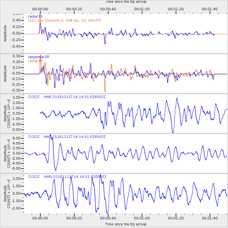
Signal To Noise
| Channel | StoN | STA | LTA |
| CI:SCI2: :HHZ:20181111T14:14:01.638003Z | 4.413062 | 1.5236441E-6 | 3.452578E-7 |
| CI:SCI2: :HHN:20181111T14:14:01.638003Z | 1.0296386 | 3.161771E-7 | 3.070758E-7 |
| CI:SCI2: :HHE:20181111T14:14:01.638003Z | 1.6848475 | 5.790981E-7 | 3.4370953E-7 |
| Arrivals |
| Ps | 5.2 SECOND |
| PpPs | 19 SECOND |
| PsPs/PpSs | 25 SECOND |


