You are here: Home > Network List > TA - USArray Transportable Network (new EarthScope stations) Stations List
> Station Z14A Wintersburg, AZ, USA > Earthquake Result Viewer
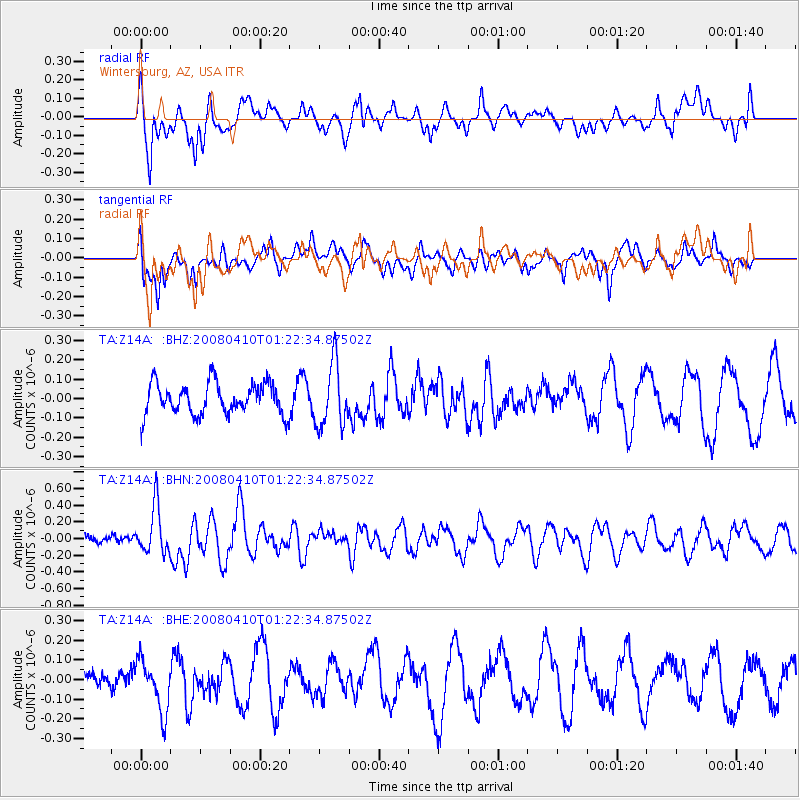
Z14A Wintersburg, AZ, USA - Earthquake Result Viewer
*The percent match for this event was below the threshold and hence no stack was calculated.
| Earthquake location: |
Loyalty Islands |
| Earthquake latitude/longitude: |
-20.3/168.9 |
| Earthquake time(UTC): |
2008/04/10 (101) 01:10:02 GMT |
| Earthquake Depth: |
35 km |
| Earthquake Magnitude: |
5.5 MB, 5.5 MS, 5.8 MW |
| Earthquake Catalog/Contributor: |
WHDF/NEIC |
|
| Network: |
TA USArray Transportable Network (new EarthScope stations) |
| Station: |
Z14A Wintersburg, AZ, USA |
| Lat/Lon: |
33.36 N/112.95 W |
| Elevation: |
298 m |
|
| Distance: |
91.6 deg |
| Az: |
55.012 deg |
| Baz: |
246.733 deg |
| Ray Param: |
$rayparam |
*The percent match for this event was below the threshold and hence was not used in the summary stack. |
|
| Radial Match: |
66.73911 % |
| Radial Bump: |
400 |
| Transverse Match: |
53.571312 % |
| Transverse Bump: |
397 |
| SOD ConfigId: |
2504 |
| Insert Time: |
2010-03-06 17:52:05.482 +0000 |
| GWidth: |
2.5 |
| Max Bumps: |
400 |
| Tol: |
0.001 |
|
Signal To Noise
| Channel | StoN | STA | LTA |
| TA:Z14A: :BHN:20080410T01:22:34.87502Z | 3.9170306 | 2.8368336E-7 | 7.242306E-8 |
| TA:Z14A: :BHE:20080410T01:22:34.87502Z | 1.2588224 | 1.3025078E-7 | 1.0347034E-7 |
| TA:Z14A: :BHZ:20080410T01:22:34.87502Z | 2.0070238 | 1.6177871E-7 | 8.060627E-8 |
| Arrivals |
| Ps | |
| PpPs | |
| PsPs/PpSs | |


