You are here: Home > Network List > TA - USArray Transportable Network (new EarthScope stations) Stations List
> Station Z14A Wintersburg, AZ, USA > Earthquake Result Viewer
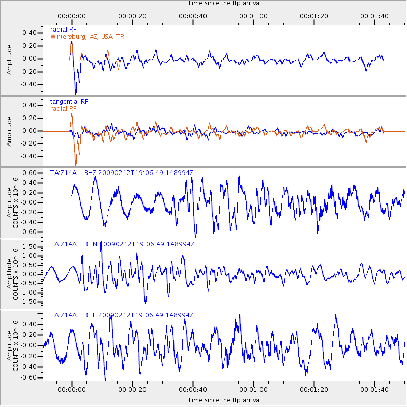
Z14A Wintersburg, AZ, USA - Earthquake Result Viewer
*The percent match for this event was below the threshold and hence no stack was calculated.
| Earthquake location: |
Kermadec Islands Region |
| Earthquake latitude/longitude: |
-31.2/-178.1 |
| Earthquake time(UTC): |
2009/02/12 (043) 18:54:28 GMT |
| Earthquake Depth: |
24 km |
| Earthquake Magnitude: |
5.6 MB, 5.6 MS, 5.9 MW, 5.8 MW |
| Earthquake Catalog/Contributor: |
WHDF/NEIC |
|
| Network: |
TA USArray Transportable Network (new EarthScope stations) |
| Station: |
Z14A Wintersburg, AZ, USA |
| Lat/Lon: |
33.36 N/112.95 W |
| Elevation: |
298 m |
|
| Distance: |
88.9 deg |
| Az: |
49.432 deg |
| Baz: |
231.035 deg |
| Ray Param: |
$rayparam |
*The percent match for this event was below the threshold and hence was not used in the summary stack. |
|
| Radial Match: |
77.54916 % |
| Radial Bump: |
360 |
| Transverse Match: |
50.58013 % |
| Transverse Bump: |
400 |
| SOD ConfigId: |
2658 |
| Insert Time: |
2010-03-06 17:52:27.657 +0000 |
| GWidth: |
2.5 |
| Max Bumps: |
400 |
| Tol: |
0.001 |
|
Signal To Noise
| Channel | StoN | STA | LTA |
| TA:Z14A: :BHN:20090212T19:06:49.148994Z | 2.1167052 | 5.128488E-7 | 2.4228638E-7 |
| TA:Z14A: :BHE:20090212T19:06:49.148994Z | 1.7979292 | 2.5222724E-7 | 1.4028764E-7 |
| TA:Z14A: :BHZ:20090212T19:06:49.148994Z | 0.84182805 | 1.9772607E-7 | 2.34877E-7 |
| Arrivals |
| Ps | |
| PpPs | |
| PsPs/PpSs | |


