You are here: Home > Network List > TA - USArray Transportable Network (new EarthScope stations) Stations List
> Station E20K Nigu River, AK, USA > Earthquake Result Viewer
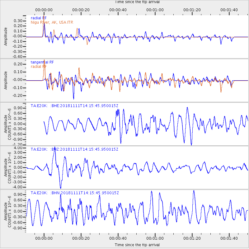
E20K Nigu River, AK, USA - Earthquake Result Viewer
*The percent match for this event was below the threshold and hence no stack was calculated.
| Earthquake location: |
North Atlantic Ocean |
| Earthquake latitude/longitude: |
15.6/-49.9 |
| Earthquake time(UTC): |
2018/11/11 (315) 14:03:59 GMT |
| Earthquake Depth: |
10 km |
| Earthquake Magnitude: |
6.2 mb |
| Earthquake Catalog/Contributor: |
NEIC PDE/us |
|
| Network: |
TA USArray Transportable Network (new EarthScope stations) |
| Station: |
E20K Nigu River, AK, USA |
| Lat/Lon: |
68.26 N/156.19 W |
| Elevation: |
866 m |
|
| Distance: |
81.6 deg |
| Az: |
338.81 deg |
| Baz: |
69.234 deg |
| Ray Param: |
$rayparam |
*The percent match for this event was below the threshold and hence was not used in the summary stack. |
|
| Radial Match: |
72.82001 % |
| Radial Bump: |
400 |
| Transverse Match: |
62.847614 % |
| Transverse Bump: |
400 |
| SOD ConfigId: |
13570011 |
| Insert Time: |
2019-05-01 19:26:09.046 +0000 |
| GWidth: |
2.5 |
| Max Bumps: |
400 |
| Tol: |
0.001 |
|
Signal To Noise
| Channel | StoN | STA | LTA |
| TA:E20K: :BHZ:20181111T14:15:45.950015Z | 5.069918 | 8.606665E-7 | 1.6975943E-7 |
| TA:E20K: :BHN:20181111T14:15:45.950015Z | 0.9645258 | 3.5367887E-7 | 3.6668678E-7 |
| TA:E20K: :BHE:20181111T14:15:45.950015Z | 0.8286814 | 2.0651322E-7 | 2.49207E-7 |
| Arrivals |
| Ps | |
| PpPs | |
| PsPs/PpSs | |


