You are here: Home > Network List > TA - USArray Transportable Network (new EarthScope stations) Stations List
> Station I30M Mount Dempster, Yukon, CAN > Earthquake Result Viewer
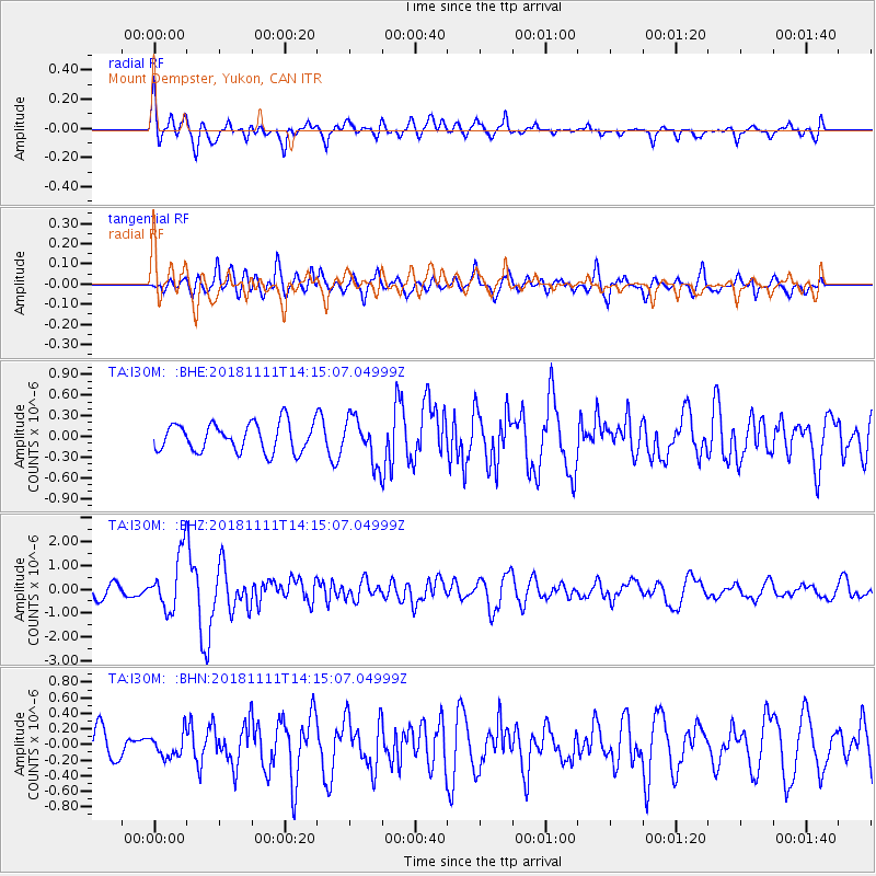
I30M Mount Dempster, Yukon, CAN - Earthquake Result Viewer
*The percent match for this event was below the threshold and hence no stack was calculated.
| Earthquake location: |
North Atlantic Ocean |
| Earthquake latitude/longitude: |
15.6/-49.9 |
| Earthquake time(UTC): |
2018/11/11 (315) 14:03:59 GMT |
| Earthquake Depth: |
10 km |
| Earthquake Magnitude: |
6.2 mb |
| Earthquake Catalog/Contributor: |
NEIC PDE/us |
|
| Network: |
TA USArray Transportable Network (new EarthScope stations) |
| Station: |
I30M Mount Dempster, Yukon, CAN |
| Lat/Lon: |
65.22 N/136.38 W |
| Elevation: |
1399 m |
|
| Distance: |
74.5 deg |
| Az: |
334.124 deg |
| Baz: |
86.479 deg |
| Ray Param: |
$rayparam |
*The percent match for this event was below the threshold and hence was not used in the summary stack. |
|
| Radial Match: |
77.71199 % |
| Radial Bump: |
400 |
| Transverse Match: |
57.50025 % |
| Transverse Bump: |
400 |
| SOD ConfigId: |
13570011 |
| Insert Time: |
2019-05-01 19:26:43.895 +0000 |
| GWidth: |
2.5 |
| Max Bumps: |
400 |
| Tol: |
0.001 |
|
Signal To Noise
| Channel | StoN | STA | LTA |
| TA:I30M: :BHZ:20181111T14:15:07.04999Z | 4.197057 | 1.2103773E-6 | 2.8838716E-7 |
| TA:I30M: :BHN:20181111T14:15:07.04999Z | 0.5865093 | 1.4985581E-7 | 2.555046E-7 |
| TA:I30M: :BHE:20181111T14:15:07.04999Z | 1.6043547 | 3.2931982E-7 | 2.0526622E-7 |
| Arrivals |
| Ps | |
| PpPs | |
| PsPs/PpSs | |


