You are here: Home > Network List > TA - USArray Transportable Network (new EarthScope stations) Stations List
> Station 219A White Tail Canyon, San Simon, AZ, USA > Earthquake Result Viewer
219A White Tail Canyon, San Simon, AZ, USA - Earthquake Result Viewer

| Earthquake location: |
Iceland |
| Earthquake latitude/longitude: |
64.0/-21.0 |
| Earthquake time(UTC): |
2008/05/29 (150) 15:46:00 GMT |
| Earthquake Depth: |
10 km |
| Earthquake Magnitude: |
6.0 MB, 6.2 MS, 6.3 MW, 6.2 MW |
| Earthquake Catalog/Contributor: |
WHDF/NEIC |
|
| Network: |
TA USArray Transportable Network (new EarthScope stations) |
| Station: |
219A White Tail Canyon, San Simon, AZ, USA |
| Lat/Lon: |
32.00 N/109.26 W |
| Elevation: |
1581 m |
|
| Distance: |
61.0 deg |
| Az: |
283.83 deg |
| Baz: |
30.241 deg |
| Ray Param: |
0.06116167 |
| Estimated Moho Depth: |
26.75 km |
| Estimated Crust Vp/Vs: |
1.93 |
| Assumed Crust Vp: |
6.182 km/s |
| Estimated Crust Vs: |
3.207 km/s |
| Estimated Crust Poisson's Ratio: |
0.32 |
|
| Radial Match: |
88.81173 % |
| Radial Bump: |
380 |
| Transverse Match: |
83.52129 % |
| Transverse Bump: |
400 |
| SOD ConfigId: |
2504 |
| Insert Time: |
2010-03-06 17:54:38.183 +0000 |
| GWidth: |
2.5 |
| Max Bumps: |
400 |
| Tol: |
0.001 |
|
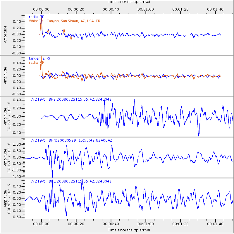
Signal To Noise
| Channel | StoN | STA | LTA |
| TA:219A: :BHN:20080529T15:55:42.824004Z | 6.617571 | 3.6625562E-7 | 5.5345932E-8 |
| TA:219A: :BHE:20080529T15:55:42.824004Z | 4.109841 | 1.8869163E-7 | 4.591215E-8 |
| TA:219A: :BHZ:20080529T15:55:42.824004Z | 2.0670736 | 8.327479E-8 | 4.0286324E-8 |
| Arrivals |
| Ps | 4.2 SECOND |
| PpPs | 12 SECOND |
| PsPs/PpSs | 16 SECOND |


