You are here: Home > Network List > TA - USArray Transportable Network (new EarthScope stations) Stations List
> Station H31M Peel River, Yukon, CAN > Earthquake Result Viewer
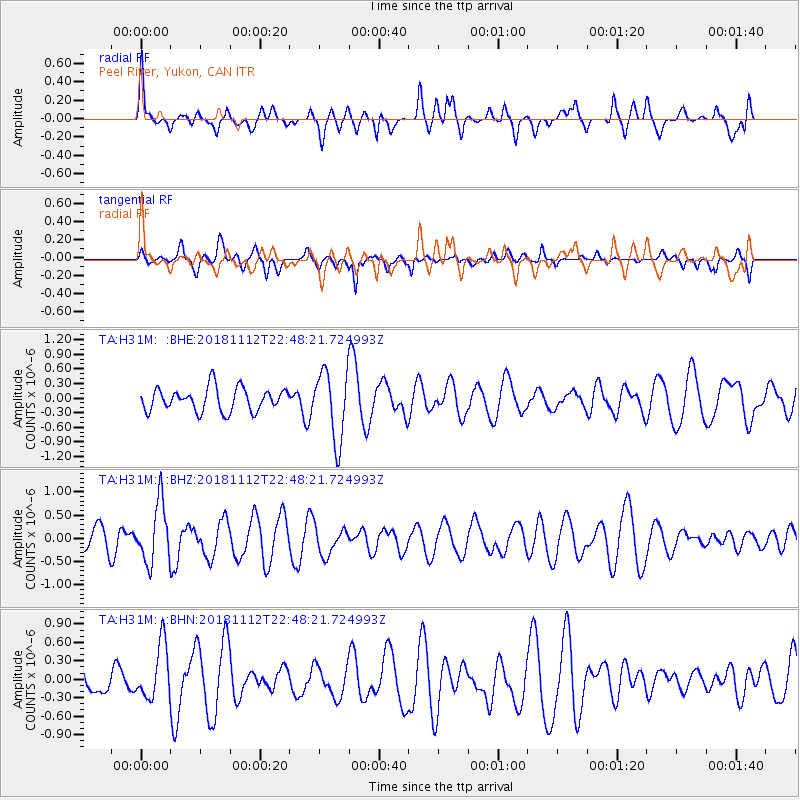
H31M Peel River, Yukon, CAN - Earthquake Result Viewer
*The percent match for this event was below the threshold and hence no stack was calculated.
| Earthquake location: |
Central East Pacific Rise |
| Earthquake latitude/longitude: |
-3.1/-103.4 |
| Earthquake time(UTC): |
2018/11/12 (316) 22:37:27 GMT |
| Earthquake Depth: |
10 km |
| Earthquake Magnitude: |
5.6 Mww |
| Earthquake Catalog/Contributor: |
NEIC PDE/us |
|
| Network: |
TA USArray Transportable Network (new EarthScope stations) |
| Station: |
H31M Peel River, Yukon, CAN |
| Lat/Lon: |
65.81 N/134.34 W |
| Elevation: |
642 m |
|
| Distance: |
72.3 deg |
| Az: |
347.157 deg |
| Baz: |
147.415 deg |
| Ray Param: |
$rayparam |
*The percent match for this event was below the threshold and hence was not used in the summary stack. |
|
| Radial Match: |
50.819214 % |
| Radial Bump: |
400 |
| Transverse Match: |
55.101215 % |
| Transverse Bump: |
334 |
| SOD ConfigId: |
13570011 |
| Insert Time: |
2019-05-01 19:37:23.373 +0000 |
| GWidth: |
2.5 |
| Max Bumps: |
400 |
| Tol: |
0.001 |
|
Signal To Noise
| Channel | StoN | STA | LTA |
| TA:H31M: :BHZ:20181112T22:48:21.724993Z | 2.676828 | 6.4462705E-7 | 2.4081754E-7 |
| TA:H31M: :BHN:20181112T22:48:21.724993Z | 2.2151427 | 4.4678183E-7 | 2.0169438E-7 |
| TA:H31M: :BHE:20181112T22:48:21.724993Z | 3.0248199 | 7.214996E-7 | 2.3852647E-7 |
| Arrivals |
| Ps | |
| PpPs | |
| PsPs/PpSs | |


