You are here: Home > Network List > TS - TERRAscope (Southern California Seismic Network) Stations List
> Station BAR Barrett Dam, California, USA > Earthquake Result Viewer
BAR Barrett Dam, California, USA - Earthquake Result Viewer
*The percent match for this event was below the threshold and hence no stack was calculated.
| Earthquake location: |
Sea Of Okhotsk |
| Earthquake latitude/longitude: |
52.3/151.5 |
| Earthquake time(UTC): |
1996/08/30 (243) 21:13:41 GMT |
| Earthquake Depth: |
580 km |
| Earthquake Magnitude: |
5.5 UNKNOWN, 5.1 MB, 5.4 MW |
| Earthquake Catalog/Contributor: |
WHDF/NEIC |
|
| Network: |
TS TERRAscope (Southern California Seismic Network) |
| Station: |
BAR Barrett Dam, California, USA |
| Lat/Lon: |
32.68 N/116.67 W |
| Elevation: |
548 m |
|
| Distance: |
65.9 deg |
| Az: |
67.376 deg |
| Baz: |
317.789 deg |
| Ray Param: |
$rayparam |
*The percent match for this event was below the threshold and hence was not used in the summary stack. |
|
| Radial Match: |
43.47946 % |
| Radial Bump: |
400 |
| Transverse Match: |
64.59005 % |
| Transverse Bump: |
400 |
| SOD ConfigId: |
4480 |
| Insert Time: |
2010-02-26 14:00:40.193 +0000 |
| GWidth: |
2.5 |
| Max Bumps: |
400 |
| Tol: |
0.001 |
|
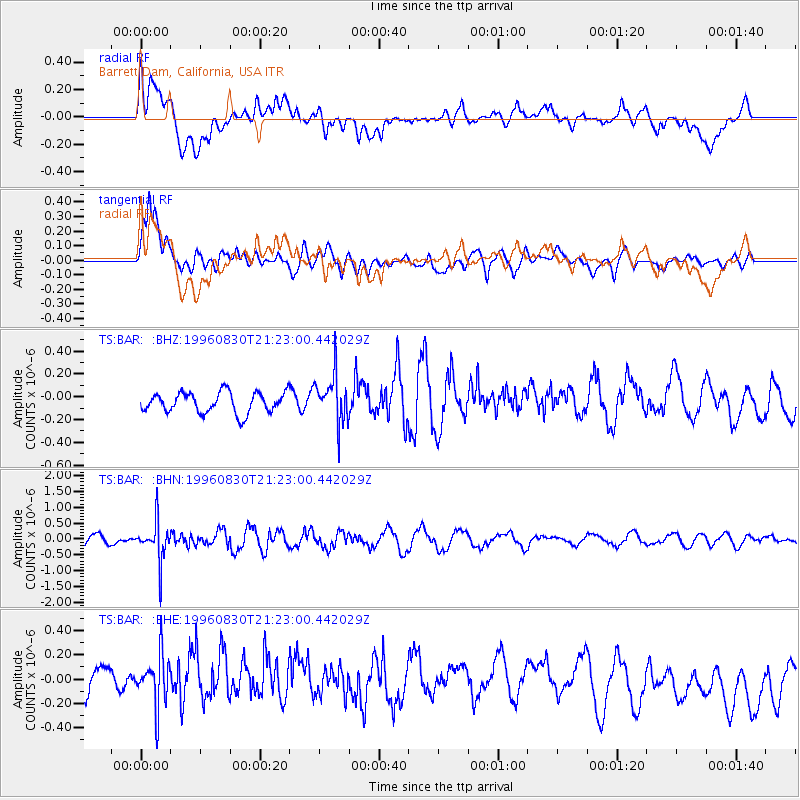
Signal To Noise
| Channel | StoN | STA | LTA |
| TS:BAR: :BHN:19960830T21:23:00.442029Z | 3.9506643 | 6.1528675E-7 | 1.557426E-7 |
| TS:BAR: :BHE:19960830T21:23:00.442029Z | 1.2361068 | 2.2523092E-7 | 1.8220992E-7 |
| TS:BAR: :BHZ:19960830T21:23:00.442029Z | 2.367127 | 2.1186548E-7 | 8.950322E-8 |
| Arrivals |
| Ps | |
| PpPs | |
| PsPs/PpSs | |


