You are here: Home > Network List > TA - USArray Transportable Network (new EarthScope stations) Stations List
> Station Y19A Nutrioso, AZ, USA > Earthquake Result Viewer
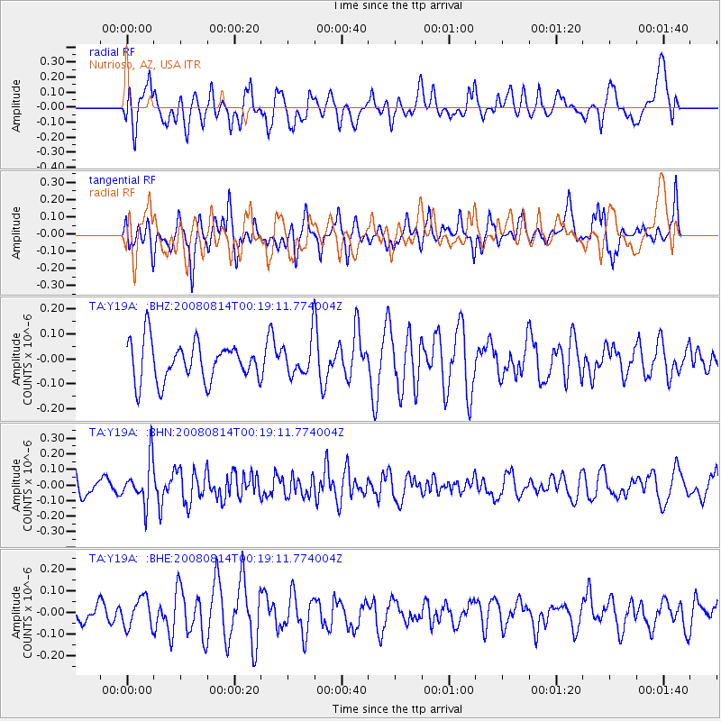
Y19A Nutrioso, AZ, USA - Earthquake Result Viewer
*The percent match for this event was below the threshold and hence no stack was calculated.
| Earthquake location: |
Mariana Islands |
| Earthquake latitude/longitude: |
16.4/146.9 |
| Earthquake time(UTC): |
2008/08/14 (227) 00:06:40 GMT |
| Earthquake Depth: |
53 km |
| Earthquake Magnitude: |
5.5 MB, 4.8 MS |
| Earthquake Catalog/Contributor: |
WHDF/NEIC |
|
| Network: |
TA USArray Transportable Network (new EarthScope stations) |
| Station: |
Y19A Nutrioso, AZ, USA |
| Lat/Lon: |
33.96 N/109.25 W |
| Elevation: |
2448 m |
|
| Distance: |
92.0 deg |
| Az: |
53.864 deg |
| Baz: |
291.18 deg |
| Ray Param: |
$rayparam |
*The percent match for this event was below the threshold and hence was not used in the summary stack. |
|
| Radial Match: |
47.327396 % |
| Radial Bump: |
400 |
| Transverse Match: |
56.663574 % |
| Transverse Bump: |
400 |
| SOD ConfigId: |
2504 |
| Insert Time: |
2010-03-06 17:59:23.660 +0000 |
| GWidth: |
2.5 |
| Max Bumps: |
400 |
| Tol: |
0.001 |
|
Signal To Noise
| Channel | StoN | STA | LTA |
| TA:Y19A: :BHN:20080814T00:19:11.774004Z | 2.43354 | 1.3893856E-7 | 5.7093185E-8 |
| TA:Y19A: :BHE:20080814T00:19:11.774004Z | 1.287705 | 6.978034E-8 | 5.4189698E-8 |
| TA:Y19A: :BHZ:20080814T00:19:11.774004Z | 0.93644214 | 7.332447E-8 | 7.830113E-8 |
| Arrivals |
| Ps | |
| PpPs | |
| PsPs/PpSs | |


