You are here: Home > Network List > TS - TERRAscope (Southern California Seismic Network) Stations List
> Station BAR Barrett Dam, California, USA > Earthquake Result Viewer
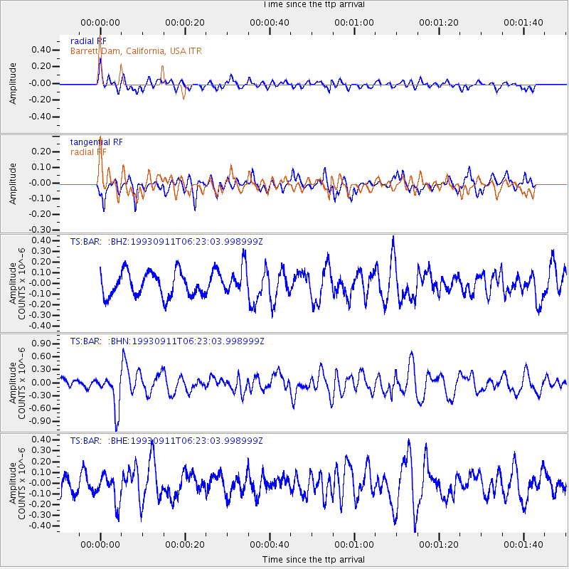
BAR Barrett Dam, California, USA - Earthquake Result Viewer
*The percent match for this event was below the threshold and hence no stack was calculated.
| Earthquake location: |
Northern Peru |
| Earthquake latitude/longitude: |
-4.7/-76.3 |
| Earthquake time(UTC): |
1993/09/11 (254) 06:14:27 GMT |
| Earthquake Depth: |
121 km |
| Earthquake Magnitude: |
5.6 MB, 5.8 UNKNOWN |
| Earthquake Catalog/Contributor: |
WHDF/NEIC |
|
| Network: |
TS TERRAscope (Southern California Seismic Network) |
| Station: |
BAR Barrett Dam, California, USA |
| Lat/Lon: |
32.68 N/116.67 W |
| Elevation: |
548 m |
|
| Distance: |
53.3 deg |
| Az: |
317.095 deg |
| Baz: |
126.427 deg |
| Ray Param: |
$rayparam |
*The percent match for this event was below the threshold and hence was not used in the summary stack. |
|
| Radial Match: |
53.44584 % |
| Radial Bump: |
400 |
| Transverse Match: |
58.775032 % |
| Transverse Bump: |
400 |
| SOD ConfigId: |
4480 |
| Insert Time: |
2010-02-26 14:00:41.831 +0000 |
| GWidth: |
2.5 |
| Max Bumps: |
400 |
| Tol: |
0.001 |
|
Signal To Noise
| Channel | StoN | STA | LTA |
| TS:BAR: :BHN:19930911T06:23:03.998999Z | 2.9955742 | 4.1711266E-7 | 1.3924299E-7 |
| TS:BAR: :BHE:19930911T06:23:03.998999Z | 1.3607415 | 1.2947685E-7 | 9.515169E-8 |
| TS:BAR: :BHZ:19930911T06:23:03.998999Z | 1.1215338 | 1.2759307E-7 | 1.1376658E-7 |
| Arrivals |
| Ps | |
| PpPs | |
| PsPs/PpSs | |


