W19A Sanders, AZ, USA - Earthquake Result Viewer
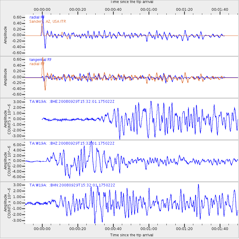
Earthquake location: Kermadec Islands, New Zealand
Earthquake latitude/longitude: -29.8/-177.7
Earthquake time(UTC): 2008/09/29 (273) 15:19:31 GMT
Earthquake Depth: 36 km
Earthquake Magnitude: 6.5 MB, 6.7 MS, 7.0 MW, 7.0 MW
Earthquake Catalog/Contributor: WHDF/NEIC
Network: TA USArray Transportable Network (new EarthScope stations)
Station: W19A Sanders, AZ, USA
Lat/Lon: 35.11 N/109.39 W
Elevation: 1785 m
Distance: 91.1 deg
Az: 49.628 deg
Baz: 233.908 deg
Ray Param: 0.041622046
Estimated Moho Depth: 32.0 km
Estimated Crust Vp/Vs: 1.62
Assumed Crust Vp: 6.496 km/s
Estimated Crust Vs: 4.01 km/s
Estimated Crust Poisson's Ratio: 0.19
Radial Match: 95.65499 %
Radial Bump: 400
Transverse Match: 92.38773 %
Transverse Bump: 400
SOD ConfigId: 2560
Insert Time: 2010-03-06 18:00:15.981 +0000
GWidth: 2.5
Max Bumps: 400
Tol: 0.001

Signal To Noise

ChannelStoNSTALTA
TA:W19A: :BHZ:20080929T15:32:01.175022Z4.94826655.279506E-71.06694046E-7
TA:W19A: :BHN:20080929T15:32:01.175022Z1.113531.5068618E-71.3532296E-7
TA:W19A: :BHE:20080929T15:32:01.175022Z2.16106182.1140032E-79.7822436E-8
Arrivals
Ps3.1 SECOND
PpPs13 SECOND
PsPs/PpSs16 SECOND