You are here: Home > Network List > UW - Pacific Northwest Regional Seismic Network Stations List
> Station UMAT Pilot Rock, OR, USA > Earthquake Result Viewer
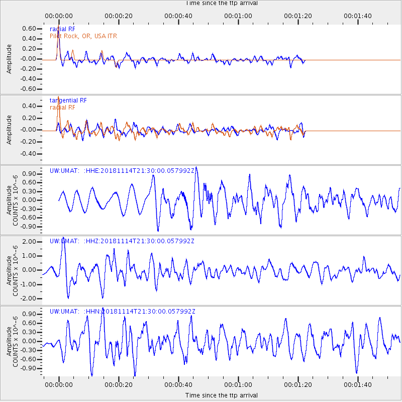
UMAT Pilot Rock, OR, USA - Earthquake Result Viewer
*The percent match for this event was below the threshold and hence no stack was calculated.
| Earthquake location: |
Near East Coast Of Kamchatka |
| Earthquake latitude/longitude: |
55.6/162.0 |
| Earthquake time(UTC): |
2018/11/14 (318) 21:21:50 GMT |
| Earthquake Depth: |
50 km |
| Earthquake Magnitude: |
6.1 Mww |
| Earthquake Catalog/Contributor: |
NEIC PDE/us |
|
| Network: |
UW Pacific Northwest Regional Seismic Network |
| Station: |
UMAT Pilot Rock, OR, USA |
| Lat/Lon: |
45.29 N/118.96 W |
| Elevation: |
1318 m |
|
| Distance: |
48.7 deg |
| Az: |
67.213 deg |
| Baz: |
312.213 deg |
| Ray Param: |
$rayparam |
*The percent match for this event was below the threshold and hence was not used in the summary stack. |
|
| Radial Match: |
67.69684 % |
| Radial Bump: |
353 |
| Transverse Match: |
61.488968 % |
| Transverse Bump: |
400 |
| SOD ConfigId: |
13570011 |
| Insert Time: |
2019-05-01 19:53:05.393 +0000 |
| GWidth: |
2.5 |
| Max Bumps: |
400 |
| Tol: |
0.001 |
|
Signal To Noise
| Channel | StoN | STA | LTA |
| UW:UMAT: :HHZ:20181114T21:30:00.057992Z | 4.802693 | 1.2294648E-6 | 2.5599488E-7 |
| UW:UMAT: :HHN:20181114T21:30:00.057992Z | 2.2456698 | 3.6914827E-7 | 1.6438224E-7 |
| UW:UMAT: :HHE:20181114T21:30:00.057992Z | 2.0202022 | 5.4057807E-7 | 2.6758613E-7 |
| Arrivals |
| Ps | |
| PpPs | |
| PsPs/PpSs | |


