You are here: Home > Network List > TJ - Tajikistan National Seismic Network Stations List
> Station GARM Garm, Tajikistan > Earthquake Result Viewer
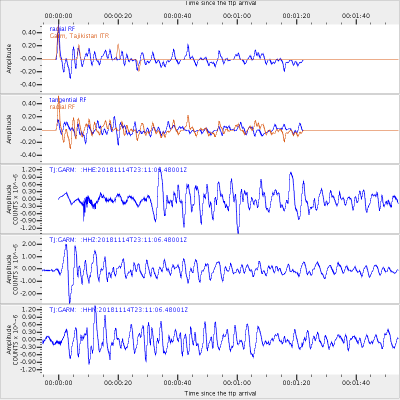
GARM Garm, Tajikistan - Earthquake Result Viewer
*The percent match for this event was below the threshold and hence no stack was calculated.
| Earthquake location: |
Sulawesi, Indonesia |
| Earthquake latitude/longitude: |
-2.9/119.4 |
| Earthquake time(UTC): |
2018/11/14 (318) 23:01:21 GMT |
| Earthquake Depth: |
13 km |
| Earthquake Magnitude: |
5.5 Mww |
| Earthquake Catalog/Contributor: |
NEIC PDE/us |
|
| Network: |
TJ Tajikistan National Seismic Network |
| Station: |
GARM Garm, Tajikistan |
| Lat/Lon: |
39.00 N/70.32 E |
| Elevation: |
1305 m |
|
| Distance: |
61.4 deg |
| Az: |
317.905 deg |
| Baz: |
120.771 deg |
| Ray Param: |
$rayparam |
*The percent match for this event was below the threshold and hence was not used in the summary stack. |
|
| Radial Match: |
75.26172 % |
| Radial Bump: |
400 |
| Transverse Match: |
71.46124 % |
| Transverse Bump: |
400 |
| SOD ConfigId: |
13570011 |
| Insert Time: |
2019-05-01 19:57:40.017 +0000 |
| GWidth: |
2.5 |
| Max Bumps: |
400 |
| Tol: |
0.001 |
|
Signal To Noise
| Channel | StoN | STA | LTA |
| TJ:GARM: :HHZ:20181114T23:11:06.48001Z | 6.583503 | 1.2811562E-6 | 1.94601E-7 |
| TJ:GARM: :HHN:20181114T23:11:06.48001Z | 2.16746 | 2.9563955E-7 | 1.3639908E-7 |
| TJ:GARM: :HHE:20181114T23:11:06.48001Z | 4.222806 | 6.4273564E-7 | 1.5220581E-7 |
| Arrivals |
| Ps | |
| PpPs | |
| PsPs/PpSs | |


