W19A Sanders, AZ, USA - Earthquake Result Viewer
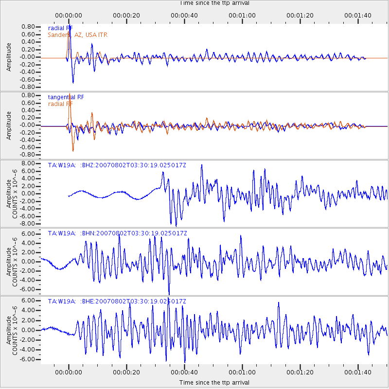
Earthquake location: Andreanof Islands, Aleutian Is.
Earthquake latitude/longitude: 51.3/-180.0
Earthquake time(UTC): 2007/08/02 (214) 03:21:42 GMT
Earthquake Depth: 21 km
Earthquake Magnitude: 6.3 MB, 6.6 MS, 6.7 MW, 6.6 MW
Earthquake Catalog/Contributor: WHDF/NEIC
Network: TA USArray Transportable Network (new EarthScope stations)
Station: W19A Sanders, AZ, USA
Lat/Lon: 35.11 N/109.39 W
Elevation: 1785 m
Distance: 51.9 deg
Az: 79.218 deg
Baz: 311.225 deg
Ray Param: 0.067070276
Estimated Moho Depth: 65.5 km
Estimated Crust Vp/Vs: 1.75
Assumed Crust Vp: 6.496 km/s
Estimated Crust Vs: 3.712 km/s
Estimated Crust Poisson's Ratio: 0.26
Radial Match: 90.81423 %
Radial Bump: 400
Transverse Match: 79.65292 %
Transverse Bump: 400
SOD ConfigId: 2564
Insert Time: 2010-03-06 18:01:26.584 +0000
GWidth: 2.5
Max Bumps: 400
Tol: 0.001

Signal To Noise

ChannelStoNSTALTA
TA:W19A: :BHN:20070802T03:30:19.025017Z1.29327.516822E-75.812575E-7
TA:W19A: :BHE:20070802T03:30:19.025017Z2.16964849.5020215E-74.379521E-7
TA:W19A: :BHZ:20070802T03:30:19.025017Z4.11975242.7957544E-66.78622E-7
Arrivals
Ps8.0 SECOND
PpPs26 SECOND
PsPs/PpSs34 SECOND