You are here: Home > Network List > TS - TERRAscope (Southern California Seismic Network) Stations List
> Station BAR Barrett Dam, California, USA > Earthquake Result Viewer
BAR Barrett Dam, California, USA - Earthquake Result Viewer
*The percent match for this event was below the threshold and hence no stack was calculated.
| Earthquake location: |
Mariana Islands |
| Earthquake latitude/longitude: |
13.0/145.0 |
| Earthquake time(UTC): |
1993/09/26 (269) 11:55:53 GMT |
| Earthquake Depth: |
73 km |
| Earthquake Magnitude: |
5.8 MB, 5.6 UNKNOWN |
| Earthquake Catalog/Contributor: |
WHDF/NEIC |
|
| Network: |
TS TERRAscope (Southern California Seismic Network) |
| Station: |
BAR Barrett Dam, California, USA |
| Lat/Lon: |
32.68 N/116.67 W |
| Elevation: |
548 m |
|
| Distance: |
90.0 deg |
| Az: |
56.549 deg |
| Baz: |
285.39 deg |
| Ray Param: |
$rayparam |
*The percent match for this event was below the threshold and hence was not used in the summary stack. |
|
| Radial Match: |
64.41505 % |
| Radial Bump: |
400 |
| Transverse Match: |
65.29767 % |
| Transverse Bump: |
400 |
| SOD ConfigId: |
4480 |
| Insert Time: |
2010-02-26 14:00:43.812 +0000 |
| GWidth: |
2.5 |
| Max Bumps: |
400 |
| Tol: |
0.001 |
|
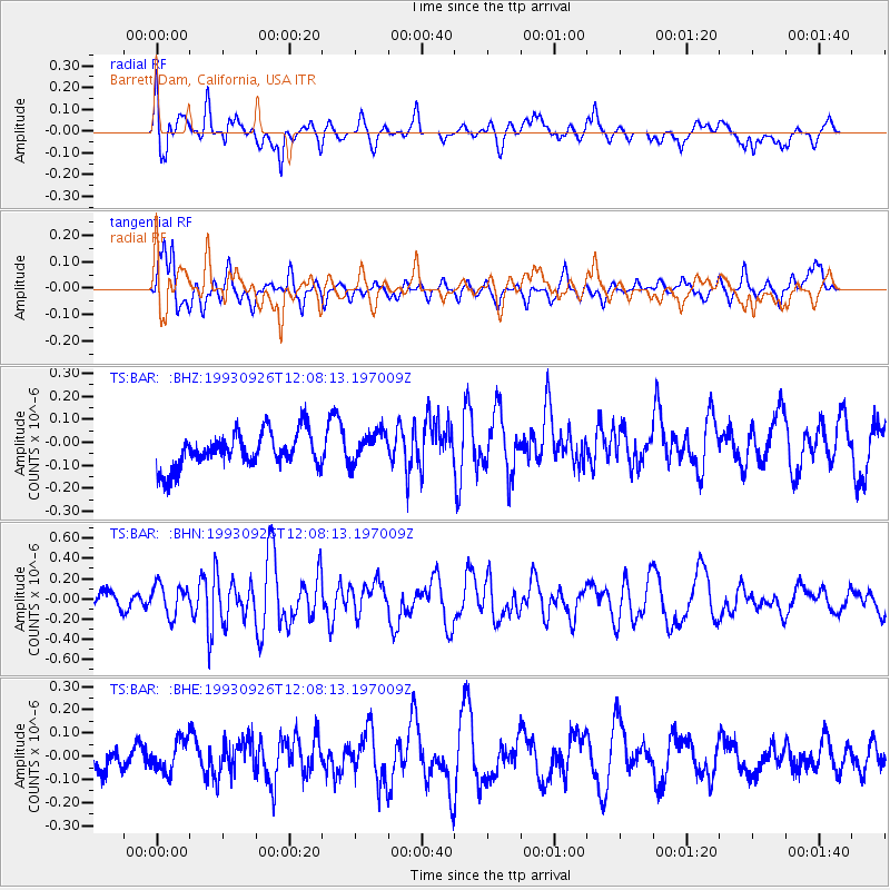
Signal To Noise
| Channel | StoN | STA | LTA |
| TS:BAR: :BHN:19930926T12:08:13.197009Z | 1.3932202 | 1.5349548E-7 | 1.10173154E-7 |
| TS:BAR: :BHE:19930926T12:08:13.197009Z | 1.0698459 | 7.127656E-8 | 6.662321E-8 |
| TS:BAR: :BHZ:19930926T12:08:13.197009Z | 0.89446783 | 6.848958E-8 | 7.6570196E-8 |
| Arrivals |
| Ps | |
| PpPs | |
| PsPs/PpSs | |


