
W19A Sanders, AZ, USA - Earthquake Result Viewer
| ||||||||||||||||||
| ||||||||||||||||||
| ||||||||||||||||||
|
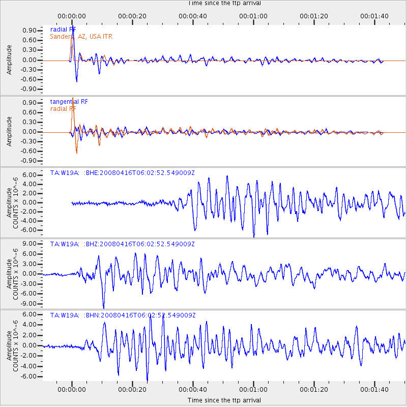
Signal To Noise
| Channel | StoN | STA | LTA |
| TA:W19A: :BHZ:20080416T06:02:52.549009Z | 6.9459023 | 9.1836927E-7 | 1.3221741E-7 |
| TA:W19A: :BHN:20080416T06:02:52.549009Z | 3.3729844 | 3.6231128E-7 | 1.0741564E-7 |
| TA:W19A: :BHE:20080416T06:02:52.549009Z | 2.7664154 | 4.8596524E-7 | 1.7566605E-7 |
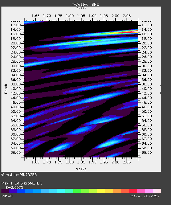
| Arrivals | |
| Ps | 2.6 SECOND |
| PpPs | 6.6 SECOND |
| PsPs/PpSs | 9.2 SECOND |

