You are here: Home > Network List > CI - Caltech Regional Seismic Network Stations List
> Station LRL Laurel Mtn Radio Fac, Ridgecrest, CA, USA > Earthquake Result Viewer
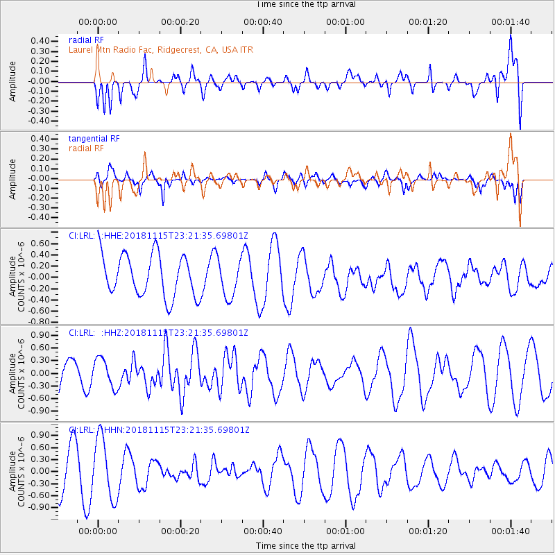
LRL Laurel Mtn Radio Fac, Ridgecrest, CA, USA - Earthquake Result Viewer
*The percent match for this event was below the threshold and hence no stack was calculated.
| Earthquake location: |
Southern East Pacific Rise |
| Earthquake latitude/longitude: |
-56.2/-122.0 |
| Earthquake time(UTC): |
2018/11/15 (319) 23:09:01 GMT |
| Earthquake Depth: |
10 km |
| Earthquake Magnitude: |
6.3 Mww |
| Earthquake Catalog/Contributor: |
NEIC PDE/us |
|
| Network: |
CI Caltech Regional Seismic Network |
| Station: |
LRL Laurel Mtn Radio Fac, Ridgecrest, CA, USA |
| Lat/Lon: |
35.48 N/117.68 W |
| Elevation: |
1340 m |
|
| Distance: |
91.4 deg |
| Az: |
3.558 deg |
| Baz: |
182.433 deg |
| Ray Param: |
$rayparam |
*The percent match for this event was below the threshold and hence was not used in the summary stack. |
|
| Radial Match: |
62.067966 % |
| Radial Bump: |
400 |
| Transverse Match: |
49.16109 % |
| Transverse Bump: |
400 |
| SOD ConfigId: |
13570011 |
| Insert Time: |
2019-05-01 20:06:02.159 +0000 |
| GWidth: |
2.5 |
| Max Bumps: |
400 |
| Tol: |
0.001 |
|
Signal To Noise
| Channel | StoN | STA | LTA |
| CI:LRL: :HHZ:20181115T23:21:35.69801Z | 0.9153411 | 3.4790722E-7 | 3.800848E-7 |
| CI:LRL: :HHN:20181115T23:21:35.69801Z | 1.9302386 | 7.850192E-7 | 4.0669542E-7 |
| CI:LRL: :HHE:20181115T23:21:35.69801Z | 0.88433754 | 3.2831383E-7 | 3.7125398E-7 |
| Arrivals |
| Ps | |
| PpPs | |
| PsPs/PpSs | |


