You are here: Home > Network List > TA - USArray Transportable Network (new EarthScope stations) Stations List
> Station T25A Trinidad, CO, USA > Earthquake Result Viewer
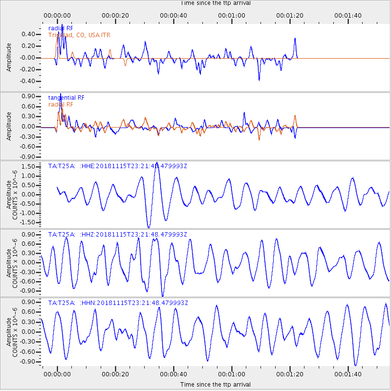
T25A Trinidad, CO, USA - Earthquake Result Viewer
*The percent match for this event was below the threshold and hence no stack was calculated.
| Earthquake location: |
Southern East Pacific Rise |
| Earthquake latitude/longitude: |
-56.2/-122.0 |
| Earthquake time(UTC): |
2018/11/15 (319) 23:09:01 GMT |
| Earthquake Depth: |
10 km |
| Earthquake Magnitude: |
6.3 Mww |
| Earthquake Catalog/Contributor: |
NEIC PDE/us |
|
| Network: |
TA USArray Transportable Network (new EarthScope stations) |
| Station: |
T25A Trinidad, CO, USA |
| Lat/Lon: |
37.14 N/104.41 W |
| Elevation: |
2017 m |
|
| Distance: |
94.2 deg |
| Az: |
14.046 deg |
| Baz: |
189.763 deg |
| Ray Param: |
$rayparam |
*The percent match for this event was below the threshold and hence was not used in the summary stack. |
|
| Radial Match: |
87.69004 % |
| Radial Bump: |
400 |
| Transverse Match: |
82.40299 % |
| Transverse Bump: |
400 |
| SOD ConfigId: |
13570011 |
| Insert Time: |
2019-05-01 20:09:15.131 +0000 |
| GWidth: |
2.5 |
| Max Bumps: |
400 |
| Tol: |
0.001 |
|
Signal To Noise
| Channel | StoN | STA | LTA |
| TA:T25A: :HHZ:20181115T23:21:48.479993Z | 1.3267663 | 5.041597E-7 | 3.7999138E-7 |
| TA:T25A: :HHN:20181115T23:21:48.479993Z | 2.1759765 | 5.081543E-7 | 2.335293E-7 |
| TA:T25A: :HHE:20181115T23:21:48.479993Z | 3.5037649 | 1.20963E-6 | 3.4523723E-7 |
| Arrivals |
| Ps | |
| PpPs | |
| PsPs/PpSs | |


