You are here: Home > Network List > TA - USArray Transportable Network (new EarthScope stations) Stations List
> Station W19A Sanders, AZ, USA > Earthquake Result Viewer
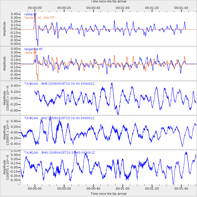
W19A Sanders, AZ, USA - Earthquake Result Viewer
*The percent match for this event was below the threshold and hence no stack was calculated.
| Earthquake location: |
Loyalty Islands |
| Earthquake latitude/longitude: |
-20.2/168.8 |
| Earthquake time(UTC): |
2008/04/28 (119) 20:26:53 GMT |
| Earthquake Depth: |
35 km |
| Earthquake Magnitude: |
5.8 MB, 5.7 MS, 6.1 MW, 6.0 MW |
| Earthquake Catalog/Contributor: |
WHDF/NEIC |
|
| Network: |
TA USArray Transportable Network (new EarthScope stations) |
| Station: |
W19A Sanders, AZ, USA |
| Lat/Lon: |
35.11 N/109.39 W |
| Elevation: |
1785 m |
|
| Distance: |
95.0 deg |
| Az: |
54.54 deg |
| Baz: |
248.894 deg |
| Ray Param: |
$rayparam |
*The percent match for this event was below the threshold and hence was not used in the summary stack. |
|
| Radial Match: |
64.95749 % |
| Radial Bump: |
400 |
| Transverse Match: |
51.919178 % |
| Transverse Bump: |
400 |
| SOD ConfigId: |
2504 |
| Insert Time: |
2010-03-06 18:02:39.230 +0000 |
| GWidth: |
2.5 |
| Max Bumps: |
400 |
| Tol: |
0.001 |
|
Signal To Noise
| Channel | StoN | STA | LTA |
| TA:W19A: :BHZ:20080428T20:39:40.649001Z | 2.736728 | 3.0355653E-7 | 1.10919515E-7 |
| TA:W19A: :BHN:20080428T20:39:40.649001Z | 0.6590743 | 9.692214E-8 | 1.4705799E-7 |
| TA:W19A: :BHE:20080428T20:39:40.649001Z | 0.78199476 | 1.0223647E-7 | 1.3073806E-7 |
| Arrivals |
| Ps | |
| PpPs | |
| PsPs/PpSs | |


