You are here: Home > Network List > TA - USArray Transportable Network (new EarthScope stations) Stations List
> Station W19A Sanders, AZ, USA > Earthquake Result Viewer
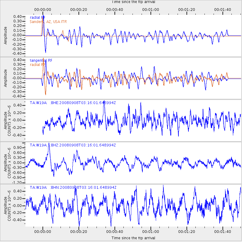
W19A Sanders, AZ, USA - Earthquake Result Viewer
*The percent match for this event was below the threshold and hence no stack was calculated.
| Earthquake location: |
Vanuatu Islands |
| Earthquake latitude/longitude: |
-20.0/169.1 |
| Earthquake time(UTC): |
2008/09/08 (252) 03:03:15 GMT |
| Earthquake Depth: |
36 km |
| Earthquake Magnitude: |
6.0 MB, 5.8 MS, 6.2 MW, 6.2 MW |
| Earthquake Catalog/Contributor: |
WHDF/NEIC |
|
| Network: |
TA USArray Transportable Network (new EarthScope stations) |
| Station: |
W19A Sanders, AZ, USA |
| Lat/Lon: |
35.11 N/109.39 W |
| Elevation: |
1785 m |
|
| Distance: |
94.6 deg |
| Az: |
54.437 deg |
| Baz: |
248.961 deg |
| Ray Param: |
$rayparam |
*The percent match for this event was below the threshold and hence was not used in the summary stack. |
|
| Radial Match: |
53.817913 % |
| Radial Bump: |
400 |
| Transverse Match: |
70.61696 % |
| Transverse Bump: |
400 |
| SOD ConfigId: |
2560 |
| Insert Time: |
2010-03-06 18:02:54.277 +0000 |
| GWidth: |
2.5 |
| Max Bumps: |
400 |
| Tol: |
0.001 |
|
Signal To Noise
| Channel | StoN | STA | LTA |
| TA:W19A: :BHZ:20080908T03:16:01.648994Z | 4.231919 | 4.8764963E-7 | 1.1523132E-7 |
| TA:W19A: :BHN:20080908T03:16:01.648994Z | 0.9858385 | 1.9289686E-7 | 1.9566782E-7 |
| TA:W19A: :BHE:20080908T03:16:01.648994Z | 1.5445338 | 2.0805119E-7 | 1.347016E-7 |
| Arrivals |
| Ps | |
| PpPs | |
| PsPs/PpSs | |


