You are here: Home > Network List > TA - USArray Transportable Network (new EarthScope stations) Stations List
> Station W19A Sanders, AZ, USA > Earthquake Result Viewer
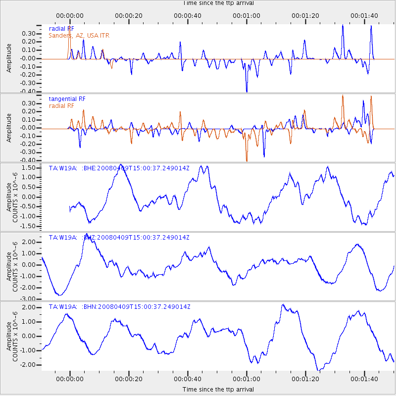
W19A Sanders, AZ, USA - Earthquake Result Viewer
*The percent match for this event was below the threshold and hence no stack was calculated.
| Earthquake location: |
Vanuatu Islands |
| Earthquake latitude/longitude: |
-20.0/168.9 |
| Earthquake time(UTC): |
2008/04/09 (100) 14:47:50 GMT |
| Earthquake Depth: |
35 km |
| Earthquake Magnitude: |
5.9 MB, 6.2 MS, 6.3 MW |
| Earthquake Catalog/Contributor: |
WHDF/NEIC |
|
| Network: |
TA USArray Transportable Network (new EarthScope stations) |
| Station: |
W19A Sanders, AZ, USA |
| Lat/Lon: |
35.11 N/109.39 W |
| Elevation: |
1785 m |
|
| Distance: |
94.8 deg |
| Az: |
54.509 deg |
| Baz: |
249.063 deg |
| Ray Param: |
$rayparam |
*The percent match for this event was below the threshold and hence was not used in the summary stack. |
|
| Radial Match: |
65.70244 % |
| Radial Bump: |
400 |
| Transverse Match: |
63.375305 % |
| Transverse Bump: |
314 |
| SOD ConfigId: |
2504 |
| Insert Time: |
2010-03-06 18:03:27.038 +0000 |
| GWidth: |
2.5 |
| Max Bumps: |
400 |
| Tol: |
0.001 |
|
Signal To Noise
| Channel | StoN | STA | LTA |
| TA:W19A: :BHZ:20080409T15:00:37.249014Z | 1.6193544 | 1.2008052E-6 | 7.415333E-7 |
| TA:W19A: :BHN:20080409T15:00:37.249014Z | 1.9581428 | 1.029743E-6 | 5.258774E-7 |
| TA:W19A: :BHE:20080409T15:00:37.249014Z | 0.18130194 | 1.5469988E-7 | 8.53272E-7 |
| Arrivals |
| Ps | |
| PpPs | |
| PsPs/PpSs | |


