You are here: Home > Network List > TA - USArray Transportable Network (new EarthScope stations) Stations List
> Station C16K Lisburne Hills, AK, USA > Earthquake Result Viewer
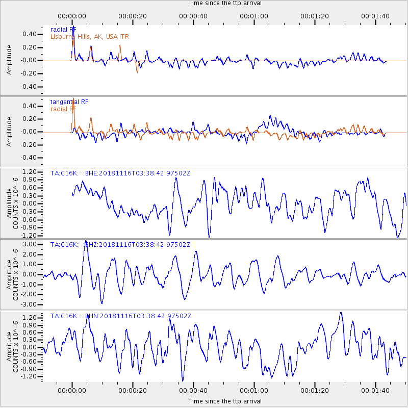
C16K Lisburne Hills, AK, USA - Earthquake Result Viewer
*The percent match for this event was below the threshold and hence no stack was calculated.
| Earthquake location: |
Solomon Islands |
| Earthquake latitude/longitude: |
-10.5/163.1 |
| Earthquake time(UTC): |
2018/11/16 (320) 03:26:55 GMT |
| Earthquake Depth: |
11 km |
| Earthquake Magnitude: |
6.2 mww |
| Earthquake Catalog/Contributor: |
NEIC PDE/us |
|
| Network: |
TA USArray Transportable Network (new EarthScope stations) |
| Station: |
C16K Lisburne Hills, AK, USA |
| Lat/Lon: |
68.27 N/165.34 W |
| Elevation: |
102 m |
|
| Distance: |
81.7 deg |
| Az: |
11.346 deg |
| Baz: |
211.307 deg |
| Ray Param: |
$rayparam |
*The percent match for this event was below the threshold and hence was not used in the summary stack. |
|
| Radial Match: |
66.441345 % |
| Radial Bump: |
400 |
| Transverse Match: |
30.541967 % |
| Transverse Bump: |
400 |
| SOD ConfigId: |
13570011 |
| Insert Time: |
2019-05-01 20:18:17.099 +0000 |
| GWidth: |
2.5 |
| Max Bumps: |
400 |
| Tol: |
0.001 |
|
Signal To Noise
| Channel | StoN | STA | LTA |
| TA:C16K: :BHZ:20181116T03:38:42.97502Z | 7.63413 | 1.5908954E-6 | 2.0839249E-7 |
| TA:C16K: :BHN:20181116T03:38:42.97502Z | 2.6414282 | 8.731533E-7 | 3.3056105E-7 |
| TA:C16K: :BHE:20181116T03:38:42.97502Z | 1.4325052 | 6.145056E-7 | 4.289727E-7 |
| Arrivals |
| Ps | |
| PpPs | |
| PsPs/PpSs | |


