You are here: Home > Network List > TS - TERRAscope (Southern California Seismic Network) Stations List
> Station BAR Barrett Dam, California, USA > Earthquake Result Viewer
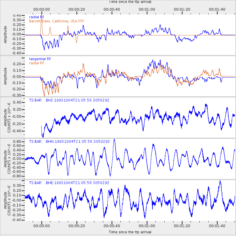
BAR Barrett Dam, California, USA - Earthquake Result Viewer
*The percent match for this event was below the threshold and hence no stack was calculated.
| Earthquake location: |
Tonga Islands |
| Earthquake latitude/longitude: |
-21.4/-174.4 |
| Earthquake time(UTC): |
1993/10/04 (277) 20:54:37 GMT |
| Earthquake Depth: |
33 km |
| Earthquake Magnitude: |
5.7 MB, 5.8 MS, 5.7 UNKNOWN, 5.8 MW |
| Earthquake Catalog/Contributor: |
WHDF/NEIC |
|
| Network: |
TS TERRAscope (Southern California Seismic Network) |
| Station: |
BAR Barrett Dam, California, USA |
| Lat/Lon: |
32.68 N/116.67 W |
| Elevation: |
548 m |
|
| Distance: |
77.0 deg |
| Az: |
47.029 deg |
| Baz: |
233.958 deg |
| Ray Param: |
$rayparam |
*The percent match for this event was below the threshold and hence was not used in the summary stack. |
|
| Radial Match: |
63.86059 % |
| Radial Bump: |
400 |
| Transverse Match: |
54.851017 % |
| Transverse Bump: |
400 |
| SOD ConfigId: |
4480 |
| Insert Time: |
2010-02-26 14:00:47.204 +0000 |
| GWidth: |
2.5 |
| Max Bumps: |
400 |
| Tol: |
0.001 |
|
Signal To Noise
| Channel | StoN | STA | LTA |
| TS:BAR: :BHN:19931004T21:05:56.305029Z | 2.4657373 | 2.9686518E-7 | 1.203961E-7 |
| TS:BAR: :BHE:19931004T21:05:56.305029Z | 2.20445 | 1.9264941E-7 | 8.739115E-8 |
| TS:BAR: :BHZ:19931004T21:05:56.305029Z | 1.2227924 | 1.9593593E-7 | 1.6023645E-7 |
| Arrivals |
| Ps | |
| PpPs | |
| PsPs/PpSs | |


